


Click Image to Enlarge
West Virginia Counties
There are fifty-five counties in the state of West Virginia. Fifty of them existed at the time of the Wheeling Convention in 1861, before which West Virginia was part of the state of Virginia. The remaining five (Grant, Mineral, Lincoln, Summers and Mingo) were formed within the state after its admission to the United States on June 20, 1863. At that time, Berkeley County and Jefferson County, the two easternmost counties of West Virginia, refused to recognize their inclusion in the state. In March 1866, the US Congress passed a joint mandate assenting to their inclusion.Jefferson County, West Virginia
Jefferson County Education, Geography, and History
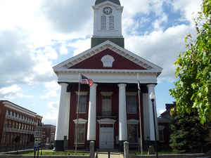
Jefferson County is the easternmost county of the state of West Virginia. Based on the 2010 census, the population was 53,498. Its county
seat is Charles Town. The county was founded in 1801.
Jefferson County is part of the Washington-Arlington-Alexandria, DC-VA-MD-WV Metropolitan Statistical Area
Etymology - Origin of Jefferson County Name
For Thomas Jefferson, author of the Declaration of Independence and 3rd President
Demographics:
County QuickFacts: CensusBureau Quick Facts
Jefferson County History
Jefferson County was formed from Berkeley County on October 26, 1801 because the citizens of southeastern Berkeley county felt they had to travel too far to the county seat of Martinsburg. Charles Washington, the founder of Charles Town and brother to George Washington petitioned for a new county to be formed. It was named for Thomas Jefferson, author of the Declaration of Independence and third President of the United States. Virginia previously had a Jefferson County, which was lost to form the new state of Kentucky. Accordingly, in the State records of Virginia, there will be listings for Jefferson County from 1780-1792 and Jefferson County from 1801-1863. Neither is still located in Virginia and despite naming a county after him twice, Virginia no longer has a county named for its hero Thomas Jefferson.
Geography: Land and Water
As reported by the Census Bureau, the county has a total area of 212 square miles (550 km2), of which 210 square miles (540
km2) is land and 2.0 square miles (5.2 km2) (1.0%) is water.
It is the only West Virginia county where the Blue Ridge Mountains and Shenandoah River that John Denver sang about in the song "Take Me Home,
Country Roads" can be found. The lowest point in the state of West Virginia is located on the Potomac River (just east of Harpers Ferry) in
Jefferson County, where it flows out of West Virginia and into Maryland.
Neighboring Counties
Bordering counties are as follows:
- North: Washington County, Md.
- Northwest: Berkeley County
- Southeast: Loudoun County, Va.
- Southwest: Clarke County, Va.; Frederick County, Va.
Education


Click Image to Enlarge
