


Click Image to Enlarge
West Virginia Counties
There are fifty-five counties in the state of West Virginia. Fifty of them existed at the time of the Wheeling Convention in 1861, before which West Virginia was part of the state of Virginia. The remaining five (Grant, Mineral, Lincoln, Summers and Mingo) were formed within the state after its admission to the United States on June 20, 1863. At that time, Berkeley County and Jefferson County, the two easternmost counties of West Virginia, refused to recognize their inclusion in the state. In March 1866, the US Congress passed a joint mandate assenting to their inclusion.Upshur County, West Virginia
Upshur County Education, Geography, and History
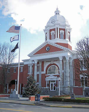
Upshur County is a county located in the state of West Virginia. Based on the 2010 census, the population was 24,254. Its county seat is Buckhannon. The county was formed in 1851 from Randolph, Barbour, and Lewis counties and named for Abel Parker Upshur, a distinguished statesman and jurist of Virginia. Upshur served as United States Secretary of State and Secretary of the Navy under President John Tyler.
Etymology - Origin of Upshur County Name
For Abel Parker Upshur, distinguished statesman and jurist of Virginia
Demographics:
County QuickFacts: CensusBureau Quick Facts
Early History of Upshur County, West Virginia
Upshur County was created by an act of the Virginia General Assembly on March 26, 1851 from parts of Barbour, Lewis and Randolph counties. The county was named in honor of Abel Parker Upshur (1790-1843).
Abel Parker Upshur was born on June 17, 1790 in Northampton County, Virginia. He studied the law and was educated at Yale and Princeton Universities. He was admitted to the bar in Richmond in 1810. He practiced law there for 10 years and then moved back to Northampton. He served as a member of the Virginia General Assembly (1820-1826), a judge in the Virginia general court, and a member of the Virginia Constitutional Convention of 1829-1830. He then served as President John Tyler's Secretary of the Navy (1841-1843) and Secretary of State (1843). He was killed when a new cannon accidently exploded on board the steamer Princeton at Mount Vernon, Virginia on February 28, 1843. Thomas Walker Gilmer, the Secretary of the Navy and the namesake of Gilmer County, was also killed in the explosion. President Tyler was present for the testing of the new gun, but survived the explosion.
Samuel and John Pringle were the first Englishmen to set foot on the present site of Upshur County. They reached the present county in 1762, after deserting their post at Fort Pitt (Pittsburgh) in 1761. They lived in the county for about three years, just a short distance from the present site of Buckhannon. It was said that they lived in the hallow of a giant sycamore tree. With their ammunition nearly exhausted, John Pringle returned to the South Branch River settlements for supplies around 1765 and discovered that the Indian wars had ended and that they were no longer wanted men. John returned to the county to inform his brother of the good news and the two of them then moved back to the South Branch River settlements. In 1769, Samuel Pringle, his wife Charity (Cutright) Pringle, and several other families returned to the Buckhannon area. Among the new settlers were John and Elizabeth Jackson and their sons, George and Edward, Thomas Hughes and John Cutright.
Buckhannon, the county seat, was legally established on January 15, 1816 on the lands of Robert Patton, Jr. The town is named for Delaware Indian Chief Buck-on-ge-ha-non, who was known as the George Washington of the Delaware Indians. His favorite hunting grounds were located near the present city. The land on which the town was formed was owned by Elizabeth Cummings Jackson. Her son, Colonel Edward Jackson, platted the town in 1815. His grandson was Thomas J. "Stonewall" Jackson, the famous General who served under the command of Robert E. Lee in the Confederate Army during the Civil War. The town was incorporated by the Virginia General Assembly in 1852.
Geography: Land and Water
As reported by the Census Bureau, the county has a total area of 355 square miles (920 km2), of which 355
square miles (920 km2) is land and 0.1 square miles (0.26 km2) (0.03%) is water.
The county falls within the United States National Radio Quiet Zone.
The highest place in elevation in Upshur County is 3160 feet, near Sugar Run on the Randolph and Upshur County lines just outside Palace
Valley and Hemlock. It is reported there is an elevation marker at the site.
Neighboring Counties
Bordering counties are as follows:
- Northeast: Barbour County
- Northwest: Lewis County; Harrison County
- Southeast: Randolph County
- Southwest: Webster County
Education


Click Image to Enlarge
