

Click Image to Enlarge
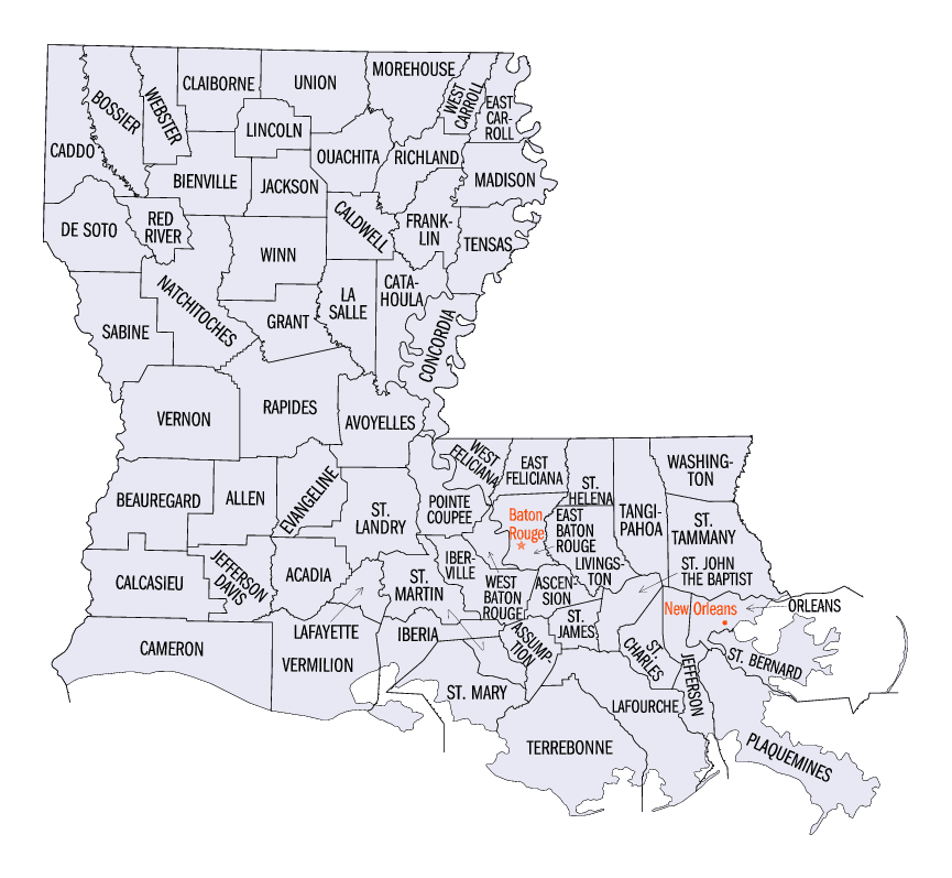
Louisiana Parishes
Louisiana is divided into sixty-four parishes. On March 31, 1807, the territorial legislature divided the state into 19 parishes, without getting rid of the old counties (which continued to exist until 1845). In 1811, a constitutional convention organized the state into seven judicial districts, each consisting of groups of parishes. In 1816, the first official map of the state used the term, as did the 1845 constitution. Since then, the official term has been parishes.Ascension Parish, Louisiana
Ascension Parish Education, Geography, and History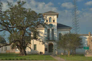
Ascension Parish is a parish located in the state of Louisiana. Based on the 2010 census, the
population was 107,215. The parish was created in 1807.
The parish seat is Donaldsonville.
Ascension Parish is named in honor of the Ascension of
Our Lord Catholic Church in Donaldsonville, Louisiana.
Ascension Parish is part of the Baton Rouge, LA Metropolitan Statistical Area as well as the Baton Rouge-Pierre Part Combined Statistical
Area. It is one of the fastest growing parishes in the state.
Etymology - Origin of Ascension Parish Name
The parish was named in honor of the Ascension of Our Lord Catholic Church in Donaldsonville, Louisiana.
Demographics:
County QuickFacts: CensusBureau Quick Facts
Ascension County History
Ascension Parish was created on 1807, from Acadia Parish and the parish was named in honor of the Ascension of Our
Lord Catholic Church in Donaldsonville, Louisiana. The Parish seat is Donaldsonville.
The first Europeans to set foot in Ascension Parish in the area now known as Donaldsonville was led by DeSoto in 1543.
The French explorer, LaSalle, named this place Lafourche des Chetimaches, "the fork in the river of the Chitimachas
Indians". Bayou Lafourche was called the "river of the Chitimachas" by the early French explorers, and referred to as
the "fork of the Chitimachas" where it branched off the Mississippi River - or, in French, La Fourche (the fork).
Ascension Parish became a Spanish Territory in 1763, and Louis Judice was named the first Spanish Commandant for
Ascension. In 1766 the Spanish Government issued land grants to Acadians from Nova Scotia and Canary Islanders. It was
their hope to reach the numerous French settlement areas along the lower Mississippi. This part of Ascension and St.
James Parishes is what came to be known as the Acadian Coast.
On August 15, 1772, on order of Charles III, King of Spain, the Ascension Catholic Church was established to serve its
parishioners.
Ascension Parish became the property of France in April, 1682, when LaSalle arrived and explored the Mississippi River.
The parish seat for Ascension is Donaldsonville, named after its founder, William Donaldson. Donaldson was formally
dedicated on April 17, 1806. The land was originally a Spanish grant, owned by a Mrs. Margaret Allain (Elaine), widow of
T. L. Landry, an Acadian exile.
Geography: Land and Water
As reported by the Census Bureau, the parish has a total area of 303 square miles (780 km2), of which 290 square miles (750 km2) is land and 13 square miles (34 km2) (4.2%) is water. It is the fourth-smallest parish in Louisiana by total area.
Ascension parish is located in southeast Louisiana. The Mississippi River flows through this parish.
Neighboring Parishes
Bordering parishes and counties are as follows:
- Northeast: Livingston Parish
- East: St. John the Baptist Parish
- Southeast: St. James Parish
- Southwest: Assumption Parish
- West: Iberville Parish
- Northwest: East Baton Rouge Parish
Education
Ascension Parish School Board operates the local public schools.
The parish is also home to private schools and - since 1998, to River Parishes Community College.


Click Image to Enlarge
