

Click Image to Enlarge
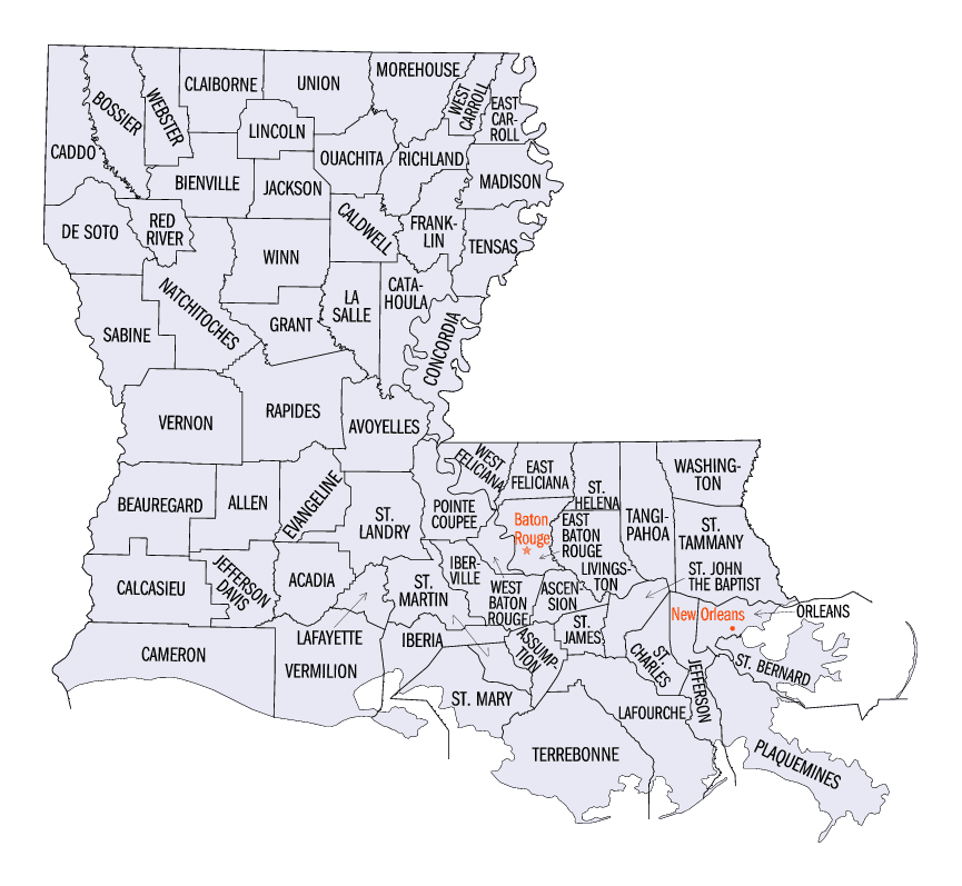
Louisiana Parishes
Louisiana is divided into sixty-four parishes. On March 31, 1807, the territorial legislature divided the state into 19 parishes, without getting rid of the old counties (which continued to exist until 1845). In 1811, a constitutional convention organized the state into seven judicial districts, each consisting of groups of parishes. In 1816, the first official map of the state used the term, as did the 1845 constitution. Since then, the official term has been parishes.Assumption Parish, Louisiana
Assumption Parish Education, Geography, and History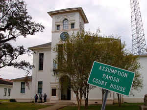
Assumption Parish is a parish located in the state of Louisiana. Based on the 2010 census, the population was 23,421. The county was formed in 1807 as an original parish of the Orleans Territory. The parish seat is Napoleonville. Assumption parish is named in honor of the Assumption Roman Catholic Church, the oldest in the state.
Etymology - Origin of Assumption Parish Name
The parish was named in honor of the Assumption Roman Catholic Church, the oldest in the state.
Demographics:
County QuickFacts: CensusBureau Quick Facts
Assumption County History
Assumption Parish was created on 1807, as an Original Parish and the parish was named in honor of the Assumption
Roman Catholic Church, the oldest in the state. The Parish seat is Napoleonville.
Prior to 1750, the French, proceeding south along Bayou Lafourche from where that stream forks with the Mississippi,
settled on both sides of "the river of the Chitimacha." They were followed by the Spanish who penetrated as far as
Napoleonville which, by the time the exiled Acadians arrived in the 1760's, had become a prosperous little colony. Upon
acquisition of the territory by the United States in 1803, English speaking land seekers came and at Napoleonville,
named by a soldier who had served under the Little Colonel, they found a thriving market place. Yet another group, the
Canary Islanders or Islenos, added to the nationalities entering the area. The Islenos were sent in 1779 and 1780 by
Governor Bernardo de Galvez to the locality near Plattenville called Valenzuela Post. The post was about at the site of
Belle Alliance, where today stands a plantation home bearing the latter name and built in 1846 by Charles Kock. Nearby
are ruins of Belle Alliance Sugarhouse, once one of the most important west of the Mississippi River, and around which a
Negro community has grown. South of the parish seat, the area around Labadieville was taken up by French and Spanish,
joined by Acadians and a sprinkling of Germans from the Cote des Allemands or German Coast to the east on the
Mississippi River. This was during the two decades after 1750. Labadieville takes its name from a pioneer resident, Jean
Louis Labadie.
Descendants of these settlers comprise a very considerable part of Assumption's present population. Upon the cession to
Spain in the 1760's the first commandant was Nicolas Verret. He was succeeded by Villaneuva. The story is told that the
transfer to the Spanish did not meet the approval of all Assumption men. One, Daspit St. Amant, loudly opposed the new
government and his arrest was ordered. St. Amant placed a keg of gunpowder in the door of his home and defied officers;
the latter retreated on his threat to explode the powder. Friends of St. Amant met them during the withdrawal and
persuaded the officers that the belligerent citizen should be left strictly alone, which was apparently done.
Following the Louisiana Purchase in 1803, the first Lafourche Parish Judge appointed by Governor W. C. C. Claiborne was
James Mather. He was succeeded by Bela Hubbard who in turn was made Parish Judge, and followed by Courvoisier, Wincelas
Pinchot (who was killed in a duel), and lastly Alexander Covillier.
Geography: Land and Water
As reported by the Census Bureau, the parish has a total area of 365 square miles (950 km2), of which 339 square miles (880 km2) is land and 26 square miles (67 km2) (7.1%) is water.
Assumption parish is located in southeast Louisiana. Lake Verret is located in this parish.
Neighboring Parishes
Bordering parishes and counties are as follows:
- Northeast: Ascension Parish; St. James Parish
- Southeast: Lafourche Parish; Terrebonne Parish
- Southwest: St. Mary Parish
- West: Iberia Parish
- Northwest: St. Martin Parish; Iberville Parish
Education
The Assumption Parish School Board operates local public schools. Assumption High School serves the whole parish.


Click Image to Enlarge
