

Click Image to Enlarge
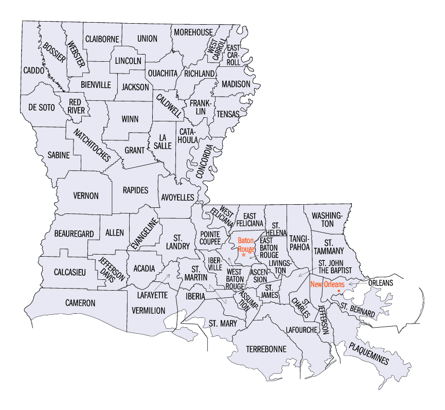
Louisiana Parishes
Louisiana is divided into sixty-four parishes. On March 31, 1807, the territorial legislature divided the state into 19 parishes, without getting rid of the old counties (which continued to exist until 1845). In 1811, a constitutional convention organized the state into seven judicial districts, each consisting of groups of parishes. In 1816, the first official map of the state used the term, as did the 1845 constitution. Since then, the official term has been parishes.Catahoula Parish, Louisiana
Catahoula Parish Education, Geography, and History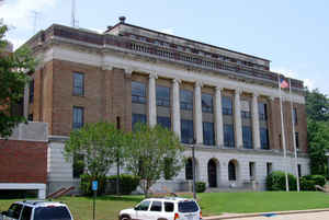
Catahoula Parish is a parish located in the state of Louisiana. Based on the 2010 census, the population was 10,407. The parish was formed in 1808, shortly after the United States acquired this territory in the Louisiana Purchase of 1803. The parish seat is Harrisonburg. Catahoula parish is named after the Catahoula Lake
Etymology - Origin of Catahoula Parish Name
The parish was named after the Catahoula Lake, formerly within the parish's boundaries (now within LaSalle Parish) and named from a Tensas word meaning big, clear lake.
Demographics:
County QuickFacts: CensusBureau Quick Facts
Catahoula County History
Catahoula Parish was the home to many succeeding Native American groups in the thousands of years before European settlements began.
Peoples of the Marksville culture, Troyville culture, Coles Creek culture and Plaquemine culture built villages and mound sites throughout the
area. Notable examples include Peck Mounds, and the Troyville Earthworks. The Troyville Earthworks have components dating from 100 BCE to 700
CE during the Baytown to the Troyville-Coles Creek periods.
It once had the tallest mound in Louisiana at 82 feet (25 m) in height; it was the second-tallest mound in North America (after Monk's Mound
at Cahokia Mounds). This mound was destroyed to make way for the Jonesville bridge over the Black River
Catahoula Parish was created on March 23, 1808, as an Original Parish and the parish was named after the Catahoula Lake, formerly within the parish's boundaries (now within LaSalle Parish) and named from a Tensas word meaning big, clear lake. The Parish seat is Harrisonburg. There was a total records destruction in the early 1900's due to unknown causes.
Geography: Land and Water
As reported by the Census Bureau, the parish has a total area of 739 square miles (1,910 km2), of which 708 square miles (1,830 km2) is land and 31 square miles (80 km2) (4.2%) is water.
Catahoula parish is located close to the center of Louisiana. This parish is home to Sandy Lake. The parish seat , Harrisonburg is located on the Ouachita River, which runs through the parish.
Neighboring Parishes
Bordering parishes and counties are as follows:
- Northeast: Franklin Parish; Tensas Parish
- Southeast: Concordia Parish
- South: Avoyelles Parish
- West: La Salle Parish
- Northwest: Caldwell Parish
Education
Catahoula Parish School Board operates local public schools.


Click Image to Enlarge
