

Click Image to Enlarge
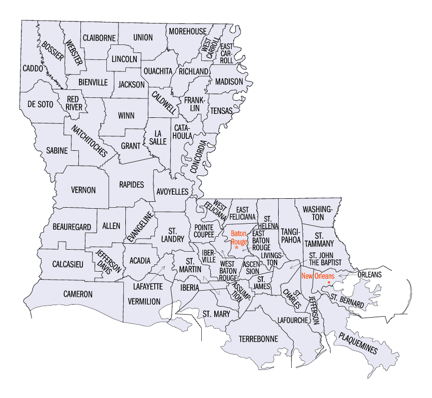
Louisiana Parishes
Louisiana is divided into sixty-four parishes. On March 31, 1807, the territorial legislature divided the state into 19 parishes, without getting rid of the old counties (which continued to exist until 1845). In 1811, a constitutional convention organized the state into seven judicial districts, each consisting of groups of parishes. In 1816, the first official map of the state used the term, as did the 1845 constitution. Since then, the official term has been parishes.Jefferson Parish, Louisiana
Jefferson Parish Education, Geography, and History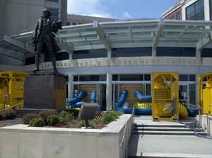
Jefferson Parish is a parish in the state
of Louisiana. Based on the 2010 census, the population was
432,552. The parish was established by the Louisiana
Legislature on February 11, 1825. The parish seat
is Gretna. Jefferson Parish is named in honor of United States
President Thomas Jefferson of Virginia.
Jefferson Parish is included in the New Orleans-Metairie, LA Metropolitan
Statistical Area.
Etymology - Origin of Jefferson Parish Name
Jefferson Parish was named in honor of United States President Thomas Jefferson of Virginia when the parish was established by the Louisiana Legislature on February 11, 1825, a year before Jefferson died. A bronze statue of Jefferson stands at the entrance of the General Government Complex on Derbigny Street at the parish seat in Gretna. The parish seat was in the City of Lafayette, until that city was annexed by New Orleans in 1854.Demographics:
County QuickFacts: CensusBureau Quick Facts
Jefferson County History
Jefferson Parish was created on 1825, from Orleans Parish and the parish was named in honor of Founding Father Thomas Jefferson. The Parish seat is Gretna.
Geography: Land and Water
As reported by the Census Bureau, the parish has a total area of 665 square
miles (1,720 km2), of which 296 square miles (770 km2)
is land and 370 square miles (960 km2) (56%) is water.
Jefferson Parish is located in southeast Louisiana. Part of the Jean Lafitte
National Historical Park and Preserve is located in this parish. Lake Pontchartrain
is located in the northern part of Jefferson Parish. The Mississippi River
is positioned around the midpoint of Jefferson Parish flowing mostly in a
north-west to south-east direction. The bulk of the southern half of Jefferson
parish is uninhabited marshland.
Neighboring Parishes
Bordering parishes and counties are as follows:
- North: Lake Pontchartrain
- Northeast: Orleans Parish
- East: Plaquemines Parish
- South: Gulf of Mexico
- West: Lafourche Parish; St. Charles Parish
Education
The parish's public schools are operated by Jefferson Parish Public Schools.


Click Image to Enlarge
