

Click Image to Enlarge
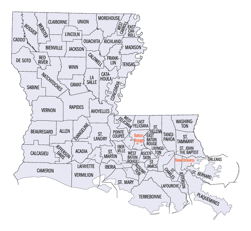
Louisiana Parishes
Louisiana is divided into sixty-four parishes. On March 31, 1807, the territorial legislature divided the state into 19 parishes, without getting rid of the old counties (which continued to exist until 1845). In 1811, a constitutional convention organized the state into seven judicial districts, each consisting of groups of parishes. In 1816, the first official map of the state used the term, as did the 1845 constitution. Since then, the official term has been parishes.Rapides Parish, Louisiana
Rapides Parish Education, Geography, and History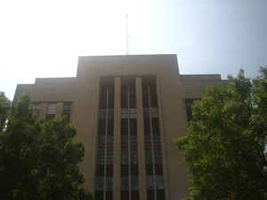
Rapides Parish is a parish located in
the state of Louisiana. Based on the 2010 census, the population
was 131,613. The parish was created in 1807. The
parish seat is Alexandria. Rapides Parish is
named for the rapids in Red River. Rapides is the French
spelling of "rapids".
Rapides Parish is included in the Alexandria, LA Metropolitan Statistical
Area.
Etymology - Origin of Rapides Parish Name
Rapides Parish was named for the rapids in Red River, during French rule and the subsequent seat of government for this area at that time, the Post of Rapide.
Demographics:
County QuickFacts: CensusBureau Quick Facts
Rapides County History
Rapides Parish was created on March 31, 1807. It is one of the 19 parishes, which were created by dividing the Territory of New Orleans. Rapides Parish was named for the rapids in Red River, during French rule and the subsequent seat of government for this area at that time, the Post of Rapide. (during Spanish rule, it was El Rapido) Rapids in the French language is Rapide, which is already pluralized. The "s" was added after the American Government took over in 1803 and has remained ever since. The Parish seat is Alexandria.
Rapides Parish Courthouse - 1939
Its first courthouse was built in 1820 though little is known about it because federal troops burned down almost the entire town of Alexandria in 1864 and most of the parish records where lost. The present courthouse was constructed in 1939 with various alterations and additions completed in 1976.
Geography: Land and Water
As reported by the Census Bureau, the parish has a total area of 1,362 square miles (3,530 km2), of which 1,318 square miles (3,410 km2) is land and 44 square miles (110 km2) (3.2%) is water.
Rapides Parish is located close to the center of Louisiana. Part of the Kisatchie National Forest is located in this parish. This is the second-largest parish in Louisiana by land area.
Neighboring Parishes
Bordering parishes and counties are as follows:
- North: Grant Parish
- Northeast: La Salle Parish
- Southeast: Avoyelles Parish
- South: Evangeline Parish
- Southwest: Allen Parish
- West: Vernon Parish
- Northwest: Natchitoches Parish
Education
Rapides Parish School Board operates public schools.


Click Image to Enlarge
