


Click Image to Enlarge
Oregon Counties
There are thyirty-six counties in the state of Oregon. The Oregon Constitution does not explicitly provide for county seats.Clackamas County, Oregon
Clackamas County Education, Geography, and History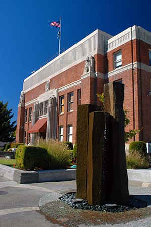
Clackamas County is a county located in the state of Oregon. Based on the 2010 census, the population was 375,992, making it the
third-most populous county in Oregon. Its county seat is Oregon City. The county was named after the Native Americans living in the area,
the Clackamas Indians, who were part of the Chinookan people.
Clackamas County is included in the Portland-Vancouver-Hillsboro, OR-WA Metropolitan Statistical Area. It is located in the Willamette
Valley.
Etymology - Origin of Clackamas County Name
Named after the Clackamas Indians, was one of the four original districts created by the Provisional Legislature on July 5, 1843.
Demographics:
County QuickFacts: CensusBureau Quick Facts
Clackamas County History
Clackamas County, named after the Clackamas Indians, was one of the
four original districts created by the Provisional Legislature on July
5, 1843. In 1843 Clackamas County covered portions of four present-day
states and one Canadian province. The Columbia River was made the northern
boundary of the county in 1844. The United States-Great Britain Boundary
Treaty of 1846 relocated the northern border of both the United States
and Clackamas County at latitude 49deg. The Act of Congress that created
Washington Territory in 1853 enclosed Clackamas County within the present-day
boundaries of Oregon. Clackamas County acquired its current boundaries
in 1854. The county is bounded by Multnomah County to the north, Wasco
County to the east, Marion County to the south, and Yamhill and Washington
Counties to the west. The county encompasses 1,879 square miles.
Oregon City became the county seat for Clackamas County. The city was
built on a portion of Dr. John McLoughlin's land claim. In 1844 Oregon
City was incorporated by the Provisional Legislature, making it the
first incorporated city west of the Rocky Mountains. This area was the
terminus for water transportation on the Willamette River and had been
a meeting place for Indians, hunters, trappers, and Hudson's Bay Company
voyagers for years.
The first major overland immigration to Oregon City occurred in 1842.
Three years later Samuel Barlow established an immigrant route that
ran from The Dalles, around the south side of Mt. Hood, and into Oregon
City. The Barlow Road funneled thousands of immigrants into Oregon City
and Clackamas County during the 1840s. Oregon City rapidly became the
primary urban center in Clackamas County and dominated social and political
life in Oregon during the provisional government period. The removal
of the territorial capital from Oregon City to Salem in 1852 shifted
most of the political activity to Salem. The creation of Multnomah County
in 1854, at the request of Portland residents, removed Oregon's principal
commercial city from Clackamas County as well as the county's access
to the Columbia River.
Prior to construction of a courthouse, county records were housed in
several locations in Oregon City, including the former provisional state
house. Two of the locations burned but the county records were saved.
In 1884 a frame and concrete structure was built at a cost of $145,000.
In 1935 the county records were moved temporarily to rented quarters
while a new courthouse was built. Using construction grants available
through the Works Progress Administration the current courthouse was
completed in 1937.
Clackamas County elected government is composed of five commissioners,
a district attorney, assessor, clerk, sheriff, surveyor, and treasurer.
Heavily timbered, the county's geographical features include Mt. Hood
and numerous rivers - the Willamette, Clackamas, Sandy, Pudding, Molalla,
and Salmon. Since its creation, agriculture, timber, manufacturing,
and commerce have been the county's principal activities. The population
of Clackamas County has steadily increased from 1850. The 2000 population
of 338,391 represented a 21.35% increase over 1990.
Geography: Land and Water
As reported by the Census Bureau, the county has a total area of 1,883 square miles (4,880 km2), of which 1,870 square miles (4,800
km2) is land and 12 square miles (31 km2) (0.7%) is water.
The county includes parts of two national forests: Mount Hood National Forest and Willamette National Forest.
Neighboring Counties
Bordering counties are as follows:
- Multnomah County - north
- Hood River County - northeast
- Wasco County - east
- Marion County - south
- Yamhill County - west
- Washington County - northwest
Education


Click Image to Enlarge
