


Click Image to Enlarge
Oregon Counties
There are thyirty-six counties in the state of Oregon. The Oregon Constitution does not explicitly provide for county seats.Curry County, Oregon
Curry County Education, Geography, and History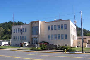
Curry County is a county located in the state of Oregon. Based on the 2010 census, the population was 22,364. The county seat is Gold
Beach. The county is named for George Law Curry, a governor of the Oregon Territory.
Curry County comprises the Brookings, OR Micropolitan Statistical Area.
Etymology - Origin of Curry County Name
Initially it was proposed that the new county be name after Captain William Tichenor, council member from Port Orford. However, he declined because his constituents wanted to honor the territorial governor, George Law Curry.
Demographics:
County QuickFacts: CensusBureau Quick Facts
Curry County History
Curry County was created on December
18, 1855, from the southern part of Coos County. Initially it was proposed that
the new county be name after Captain William Tichenor, council member from Port
Orford. However, he declined because his constituents wanted to honor the
territorial governor, George Law Curry.
Curry County is situated along the Pacific Coast in the southwest corner of
Oregon. It is bounded on the south by California, on the west by the Pacific
Ocean, on the north by Coos County, and on the east by Josephine County. The
county originally contained about 1,500 square miles. However, boundary
adjustments with Coos County in 1872 and 1951 and Josephine County in 1880 and
1927 increased the area to 1,648 square miles.
Upon creation of Curry County, the Territorial Legislature fixed the county seat
temporarily at Port Orford until the citizens of the county could determine a
permanent site. In 1859, following an informal vote of county citizens during
the general election, Ellensburg was designated the county seat. In 1891
Ellensburg was renamed Gold Beach because of the gold and other minerals found
in the sands in this area and to eliminate confusion with the city of Ellensburg
located in the state of Washington.
The first courthouse was in Judge Fred Smith's home in Port Orford. Apparently
the town's inability to finance the construction of a proper courthouse was a
factor in the vote that favored the move to Gold Beach. The first courthouse in
Gold Beach was replaced in 1912. The current courthouse was constructed in 1958.
The government of Curry County consisted originally of a probate judge, a three
member board of commissioners, sheriff, auditor, treasurer, and coroner. The
county judge`s position was replaced by a board of commissioners in 1969. Port
districts were established at Port Orford in 1919 and Gold Beach in 1955.
The first county census in 1860 showed a population of 393. There has been a
steady increase in population with the 2000 population given at 21,137, a 9.37%
increase over 1990.
In 1852 explorers discovered gold and other precious metals in the rivers and
along the beaches of this area. Initially settlement in the county was
concentrated along the coast and depended primarily on water transportation. The
slow development of inland transportation routes kept the county relatively
isolated well into the twentieth century. While there is still some mining of
cobalt, nickel, and chromium in the Gasaquet Mountain area, the economy has
reoriented to agriculture and timber. Port Orford cedar (Lawson Cypress) and
myrtlewood are important export products. The county has excellent grazing areas
for raising cattle and sheep. The county also produces blueberries,
horticultural nursery stock, and ninety percent of all Easter lilies raised in
the United States. Vacation and recreational possibilities in the county draw
tourists to the area and provide additional economic diversity.
Geography: Land and Water
As reported by the Census Bureau, the county has a total area of 1,988 square miles (5,150 km2), of which 1,627 square miles (4,210 km2)
is land and 361 square miles (930 km2) (18%) is water.
The westernmost point in Oregon is in Curry County at Cape Blanco
The county contains significant forests, with occurrence of black oak, big leaf maple and Douglas-fir. The blue oak, prevalent slightly
further south does not reach into Curry County.
Neighboring Counties
Bordering counties are as follows:
- Coos County (north)
- Douglas County (northeast)
- Josephine County (east)
- Del Norte County, California (south)
Education


Click Image to Enlarge
