


Click Image to Enlarge
Oregon Counties
There are thyirty-six counties in the state of Oregon. The Oregon Constitution does not explicitly provide for county seats.Josephine County, Oregon
Josephine County Education, Geography, and History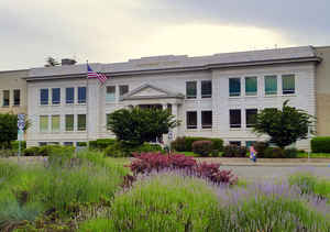
Josephine County is a county located in the state of Oregon. Based on the 2010 census, the population was 82,713. The county seat is
Grants Pass. The county is probably named after a stream in the area called Josephine Creek, which in turn is probably named after Virginia
Josephine Rollins Ort.
Josephine County comprises the Grants Pass, OR Metropolitan Statistical Area, which is included in the Medford-Grants Pass, OR Combined
Statistical Area.
Etymology - Origin of Josephine County Name
Josephine County was named for Josephine Rollins, the first white woman to settle in southern Oregon.
Demographics:
County QuickFacts: CensusBureau Quick Facts
Josephine County History
Josephine County is located in
southwestern Oregon and was created by the Territorial Legislature on January
22, 1856, from the western half of Jackson County. It was the nineteenth, and
last, county created before statehood. Josephine County was named for Josephine
Rollins, the first white woman to settle in southern Oregon.
The county is bordered on the south by California, on the north by Douglas
County, on the west by Curry County at the Coast Range summit, and on the east
by Jackson County. Josephine County is predominantly mountainous, but has two
major valleys cut by the Rogue and Illinois Rivers.
Sailor Diggings was named the first county seat of Josephine County in 1856.
During the next year, the population center shifted north to the Illinois Valley
and to Kerbyville, a town which had been founded earlier that year by James
Kerby. Kerbyville was chosen by the electorate as the new county seat in 1857.
In 1858 the Territorial Legislature changed its name to Napoleon, but Kerbyville,
and later, Kerby, remained the favored usage in the county. In 1886, the county
seat was relocated to Grants Pass, a new town built along the recently completed
railroad which traversed the state.
The first county courthouse was a log cabin at Sailor Diggings, which later came
to known as Waldo. The building was purchased for $100 from James Hendershott in
1856. In 1858 when Kerbyville became the new county seat, the commissioners
ordered the sheriff to sell the courthouse at Sailor Diggings. Between 1858 and
1886 court records were kept in various offices and buildings rented by the
county in Kerbyville. In 1886 the county seat was relocated to Grants Pass where
courthouses were built in 1887 and 1917.
County officers were elected in June, 1856, and included three county
commissioners, sheriff, auditor, treasurer, probate judge, and coroner. The US
district court held its first session at Sailor Diggings in 1856. Josephine
County government currently consists of three commissioners, district attorney,
assessor, clerk, sheriff, surveyor, and treasurer.
Most of the commercial activity during the territorial period centered on gold
mining and the supply of provisions to miners. Miners had been active in the
Rogue and Illinois Valleys since 1851. By the late 1850s, however, gold mining
was beginning to decline and population dwindled as well. In 1859, gold was
discovered along the Fraser River in British Columbia and an exodus from
Josephine County occurred.
Although several Indian tribes lived in the area from which Josephine County was
created, most of their members had been moved to reservations by 1856. In late
1856 all Indians in southwest Oregon, with the exception of a few tiny bands,
were moved to the Siletz Reservation in Polk County.
Josephine County was also the home to a large Chinese population. Most had come
to the area to work gold claims purchased from whites no longer interested in
working them. Even though they could not own land, they had to pay a tax to mine
gold, and were relegated to inferior claims.
Population in Josephine County has steadily increased except in the 1910s when
there was a 20% decrease. In 2000 the population of 75,726 represented a 20.87%
increase from 1990. The principal industries are lumber, tourism, and
agriculture.
Geography: Land and Water
As reported by the Census Bureau, the county has a total area of 1,642 square miles (4,250 km2), of which 1,640 square miles (4,200 km2) is land and 2.2 square miles (5.7 km2) (0.1%) is water.
Neighboring Counties
Bordering counties are as follows:
- Curry County (west)
- Jackson County (east)
- Douglas County (north)
- Del Norte County, California (southwest)
- Siskiyou County, California (south)
Education


Click Image to Enlarge
