


Click Image to Enlarge
Oregon Counties
There are thyirty-six counties in the state of Oregon. The Oregon Constitution does not explicitly provide for county seats.Washington County, Oregon
Washington County Education, Geography, and History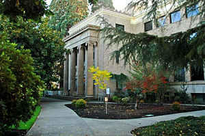
Washington County is one of 36 counties in the state of Oregon. Based on the 2010 census, the population was 529,710, making it the
second most populous county in the state. The county seat and largest city is Hillsboro.
Washington County is included in the Portland-Vancouver-Hillsboro, OR-WA Metropolitan Statistical Area.
Etymology - Origin of Washington County Name
In 1849, the Territorial Legislature changed the name of Tuality County to Washington in honor of President George Washington.
Demographics:
County QuickFacts: CensusBureau Quick Facts
Washington County History
The Provisional Legislature created
Washington County as Tuality District on July 5, 1843, as one of the four
original counties created in Oregon. Tuality County was bordered on the north by
latitude 54deg. 40min., on the east by Clackamas County, on the west by the
Pacific Ocean, and on the south by Yamhill County. In 1844, the Columbia River
was made the northern boundary of Tuality County and Clatsop County was created
from Tuality County's western half. In 1849, the Territorial Legislature changed
the name of Tuality County to Washington in honor of President George
Washington. Washington County obtained its present boundaries in 1854 with the
creation of Columbia County to the north and Multnomah County to the east. The
area of Washington County is 727 square miles.
Columbia was selected as the county seat in 1850. Later, the town was given the
name of Hillsborough, which in 1858 was modified to Hillsboro. After meeting in
two local church buildings, a permanent county headquarters was built in 1852. A
brick courthouse was built in 1873 and remodeled in 1891. In 1912 an annex was
built. A new courthouse was built in 1928 to replace the original brick
structure. The Justice Services Building was added on to the courthouse in 1972.
The Public Services Building was constructed in 1990 to house most county
offices. The Walnut Street Center opened in 1999 and houses many Land Use and
Transportation Department offices.
Although Tuality County government was established in 1843, a complete county
government was not organized until 1845 when three county judges having probate
and administrative authority, a treasurer, and a sheriff were appointed. The
first election of county and territorial officers was held in 1846.
The voters of Washington County approved a home rule charter at the general
election in 1962. The new county government was headed by the county
administrative officer and board of county commissioners, which is the
five-member policy making body of the county. Under home rule, most county
services are provided by broad functional departments, such as assessment and
taxation, health and human services, and land use and transportation.
Washington County is one of the fastest developing areas in Oregon. Its
population of 445,342 in 2000 represented an increase of 42.94% since 1990. The
2006 population of 500,585 marked a 12.4% increase since 2000. The development
of a large electronics industry during the last two decades has contributed
significantly to the economy of the county. Other principle industries are
agriculture, lumber, manufacturing, and food processing. The headquarters of
Nike, the world's leading supplier of athletic shoes, apparel, and sports
equipment, are near Beaverton.
Geography: Land and Water
As reported by the Census Bureau, the county has a total area of 726 square miles (1,880 km2), of which 724 square miles (1,880 km2) is
land and 2.2 square miles (5.7 km2) (0.3%) is water. It is located approximately 20 miles (32 km) to the west of Portland. The Portland Metro
Urban Growth Boundary (UGB) bisects the county. The county's highest point is South Saddle Mountain at 3,464 feet (1,056 m) above sea level in
the Northern Oregon Coast Range.
Most of the county is in the Tualatin Valley, which is surrounded by the Tualatin Mountains to the east and north, the Chehalem Mountains to
the south, and the Northern Oregon Coast Range to the west and north. In the valley is the only river in the county, the Tualatin River, the
Tualatin Plains, and several small hills.[citation needed] The northern and western portions of the county are forested, while the remainder
of the county includes urban areas, agricultural lands, and floodplains
Neighboring Counties
Bordering counties are as follows:
- Clackamas County (southeast)
- Clatsop County (northwest)
- Columbia County (north)
- Multnomah County (east)
- Tillamook County (west)
- Yamhill County (south)
Education


Click Image to Enlarge
