

Click Image to Enlarge
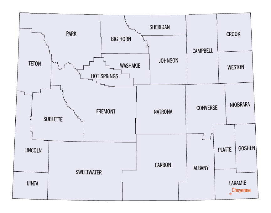
Wyoming Counties
There are twenty-three Counties in the state of Wyoming. There were originally five Counties in the Wyoming Territory: Laramie and Carter, established in 1867; Carbon and Albany established in 1868; and Uinta, an annexed portion of Utah and Idaho, extending from Montana (including Yellowstone Park) to the Wyoming-Utah boundary. On July 10, 1890, Wyoming was admitted to the Union with thirteen counties.Goshen County, Wyoming
Goshen County Education, Geography, and History
Goshen County is a county located in the state of Wyoming. Based on the 2010 census, the population was 13,249. Its county seat is Torrington. The eastern boundary of the County borders the Nebraska state line.
Etymology - Origin of Goshen County Name
From the biblical "Land of Goshen", for the rich, fertile lands and plentiful water. Also said to have been named for a French trapper, Gosche.
Demographics:
County QuickFacts: CensusBureau Quick Facts
Goshen County History
Goshen County was organized in 1911.
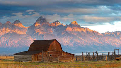
Goshen County via Torrington is the Gateway to the West. Traversed by people using the Oregon, Mormon, California
and Texas Trails, the Cheyenne-Deadwood Stage Road, Pony Express and overland telegraph lines of pioneer days, the
North Platte River Valley is one of the most historic sections of the West. With the North Platte River as their
guide, the first sizable group of emigrants from the east crossed into Wyoming country in 1843. They camped along
the Platte in southeastern Wyoming in what is now Goshen County.
For two decades, the county served as the western doorway for some 350,000 pioneers who followed the Oregon Trail.
This pioneer trail sliced diagonally through the county which has some of the most historic sites in the state.
Visitors and residents alike enjoy the many local attractions found throughout the area. The Homesteaders Museum is
the first stop for visitors as they delve into the history of this area. Another enjoyable stop is the Western
History Center located five miles west of Lingle. Many artifacts detailing the history of Goshen County are on
display.
Fort Laramie National Historic Site, another favorite site, offers a glimpse into the past through the Living
History Program, which continues throughout the summer. The fort site, the first settlement within what is now
Wyoming, was established in present day Goshen County in 1834 at the junction of the Laramie and North Platte
Rivers. The early history of the county centers around Fort Laramie and the Oregon Trail. In the summer of 1999,
both the Ft. Laramie National Historic Site and the California Gold Rush Trail celebrated Sesquicentennials --150
years of existence.
The valley has been agriculturally-oriented for centuries, primarily because it escapes most of the severe winter
storms the surrounding areas experience. The principal industry today is agriculture. More than 200,000 cattle are
raised and marketed in Goshen County, which makes it the leading beef producer in the state. The local live stock
auction is the fifth largest in the country. Potatoes, beans, corn, wheat and other grains, and alfalfa are among
the crops produced. Sugar beets are grown and processed locally. An ethanol plant, south of Torrington, has
increased the number of local value-added products.
Indian tribes lived in the valley where they grew crops and hunted on the uplands. They were driven out by nomadic
tribes and eventually trappers and traders took over this location. There are only a few towns in Goshen County,
most of which emerged by the homestead areas. Torrington, the county seat, became a city January 1, 2000. It was
given its name in 1889 by a local settler who wished a name for the post office he was establishing, and chose the
name of his birthplace in Connecticut.
Geography: Land and Water
As reported by the Census Bureau, the county has a total area of 2,232 square miles (5,781 km2), of which,
2,225 square miles (5,764 km2) of it is land and 7 square miles (18 km2) of it (0.31%) is water.
Neighboring Counties
Bordering counties are as follows:
- Niobrara County, Wyoming - north
- Platte County, Wyoming - west
- Laramie County, Wyoming - south
- Banner County, Nebraska - southeast
- Scotts Bluff County, Nebraska - east
- Sioux County, Nebraska - east
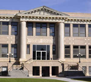
Education


Click Image to Enlarge
