

Click Image to Enlarge
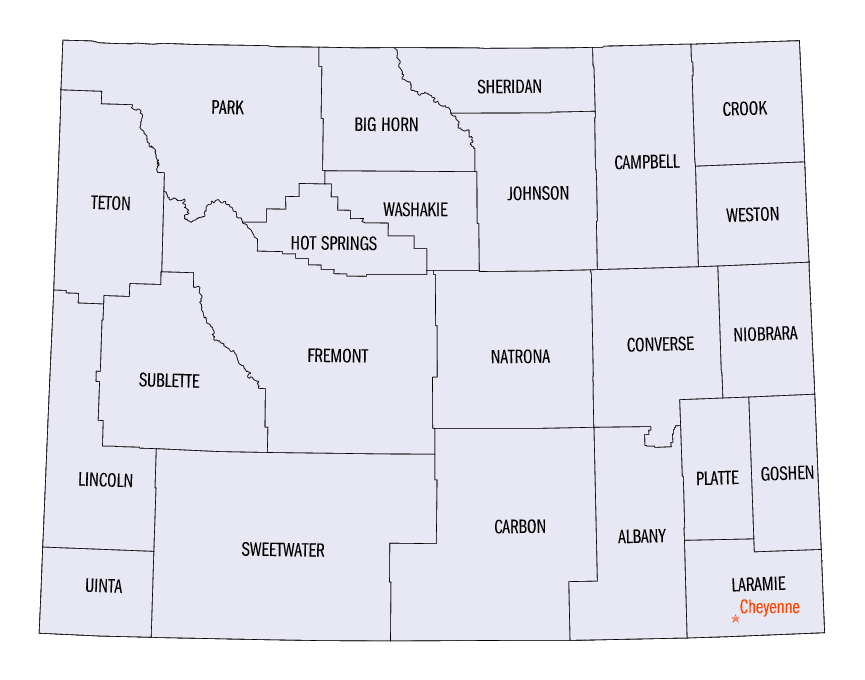
Wyoming Counties
There are twenty-three Counties in the state of Wyoming. There were originally five Counties in the Wyoming Territory: Laramie and Carter, established in 1867; Carbon and Albany established in 1868; and Uinta, an annexed portion of Utah and Idaho, extending from Montana (including Yellowstone Park) to the Wyoming-Utah boundary. On July 10, 1890, Wyoming was admitted to the Union with thirteen counties.Natrona County, Wyoming
Natrona County Education, Geography, and History
Natrona County is a county located in the state of Wyoming. Based on the 2010 census, the population was 75,450, making it the
second-most populous county in Wyoming. Its county seat is Casper.
Natrona County comprises the Casper, WY Metropolitan Statistical Area.
Etymology - Origin of Natrona County Name
Named for the natron, or soda deposits in the county.
Demographics:
County QuickFacts: CensusBureau Quick Facts
Natrona County History
Natrona County was initially organized in the year 1888. the first settlement occurred in the Casper area in the late 1800s.
Wyoming's plains are the historical home to many nomadic tribes including the Cheyenne, Arapaho, Shoshone and Sioux. Today, about 6,000 Shoshone and Arapaho continue to reside on the 2.3 million acre Wind River Reservation, northwest of Natrona County.
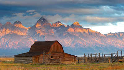
Natrona county has a vast and varied history, from the Teapot Dome scandal to the oil and gas fields. Wyoming with its natural beauty and the history have attracted movie makers from John Wayne movies to science fiction movies.
In 1812, John Jacob Astor established Astoria at the mouth of the Columbia and sent Robert Stuart east to start what was
hoped to become a network of trading posts. Stuart found South Pass by following a Crow Indian trail and entered our
region. Near Bessemer Bend, Stuart and his small band erected the first white man's hut in 1812. Although Astor's plans
failed when the British captured Astoria in 1812, trappers and scouts continued to explore our high plains and develop
transit routes. On July 4, 1824, some of these trappers named Independence Rock.
In 1840, Father Jean Pierre DeSmet began spreading the gospel among area Indians. Father DeSmet was the first to carve
his name on Independence Rock and give it the name, "The Register of the Desert."In 1843, John C. Fremont (known as
"The Pathfinder") chiseled his name on Independence Rock and later with Kit Carson as his guide, went on to explore the
country along the Platte and Sweetwater Rivers.
Geography: Land and Water
As reported by the Census Bureau, the county has a total area of 5,376 square miles (13,923 km2), of which, 5,340 square miles (13,830 km2) of it is land and 36 square miles (93 km2) of it (0.67%) is water.
Natrona County is located in the central part of Wyoming and consists of 5,369 square miles, covering 3,436,160 acres with a population of almost 65,000. The county seat is in Casper, which offers a multitude of choices for a wealth of natural and cultural history. Casper is the only place where the Oregon, Mormon, Overland, Pony Express, and Bridger Trails intersect. Cattle and sheep ranching were among the first enterprises, and diverse geological formations fostered the development of an energy industry fueled by oil, gas, coal, and uranium.
Neighboring Counties
Bordering counties are as follows:
- Johnson County (north)
- Converse County (east)
- Carbon County (south)
- Fremont County (west)
- Washakie County (northwest)
Education


Click Image to Enlarge
