


Click Image to Enlarge
Colorado Counties
Colorado currently has sixty-four counties. In February 1866, the first new county, Las Animas, was created. Alamosa was created in 1913, and in 2001, Broomfield was recognized as a city-county, bringing a total of 64 counties.Custer County, Colorado
Custer County Education, Geography, and History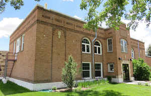
Custer County is the tenth-least populous of the 64 counties in the state of Colorado. Based on the 2010 census, the population was 4,255. The county seat is Westcliffe. Custer County was created on March 9, 1877 from Fremont County. The county is named in honor of George Armstrong Custer, (1839 - 1876), the US Army colonel defeated and killed at the Battle of Little Bighorn.
Etymology - Origin of Custer County Name
Custer County is named in honor of George Armstrong Custer, the US Army Colonel defeated at the Battle of Little Bighorn.
Demographics:
County QuickFacts: CensusBureau Quick Facts
Custer County History
Custer County was created by the Colorado legislature on March 9, 1877, out of the southern half of Fremont County. Originally set in Ula, the county seat moved to Rosita in 1878, and to Silver Cliff in 1886 before settling in Westcliffe in 1928. The county is named in honor of Lt. Colonel George Armstrong Custer, who had died the previous year.
Geography: Land and Water
As reported by the Census Bureau, the county has a total area of 740 square miles (1,916 km2), of
which, 739 square miles (1,914 km2) of it is land and 1 square miles (3 km2) of it (0.14%) is water.
Custer county is located close to the center of Colorado. The county is rugged and would be inaccessible without roads. The lowest point of the
county is around 6,000 feet (1,800 m) in elevation, but most of the county is rugged and mountainous.
The county seat of Westcliffe is about 7,800 feet (2,400 m) and along with nearby town Silver Cliff lies
in the Wet Mountain Valley which sits at the base of the Sangre de Cristo Mountains. The peaks of the
Sangre de Cristo Mountains to the west reach heights in excess of 14,000 feet (4,300 m) with Crestone
Peak being the highest at 14,294 feet (4,357 m).
Neighboring Counties
Bordering counties are as follows:
- North: Fremont County
- East: Pueblo County
- Southeast: Huerfano County
- West: Saguache County
Education


Click Image to Enlarge
