


Click Image to Enlarge
Colorado Counties
Colorado currently has sixty-four counties. In February 1866, the first new county, Las Animas, was created. Alamosa was created in 1913, and in 2001, Broomfield was recognized as a city-county, bringing a total of 64 counties.Garfield County, Colorado
Garfield County Education, Geography, and History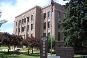
Garfield County is one of the 64 counties in the state of Colorado. Based on the 2010 census, the
population was 56,389. The county
seat
is Glenwood Springs. Garfield County was created on
February 10, 1883 from Summit County. The county is named in honor of United States President James A. Garfield.
Garfield County is included in the Glenwood Springs, CO Micropolitan Statistical Area, which is also included in the Edwards-Glenwood Springs,
CO Combined Statistical Area.
Etymology - Origin of Garfield County Name
Garfield County is named in honor of James Abram Garfield, the twentieth President of the United States.
Demographics:
County QuickFacts: CensusBureau Quick Facts
Garfield County History
Garfield County is located in the scenic plateau and canyon country of western Colorado.
The county covers 3000 square miles,
it is 110 miles long and extends to the Utah border. The county was carved out of Summit County on February 10, 1883. In
historical times, the earliest inhabitants were the Ute Indians, and the land was theirs by treaty until April 12, 1880,
when they were removed to reservations after the "Meeker Massacre" of 1879. Although explorers, missionaries, miners,
and a few settlers had already visited the area of Garfield County, the main influx of settlers began to arrive and
towns were founded beginning in 1880.
The towns in Garfield County are located along the Colorado and Roaring Fork rivers in the eastern end of the county,
while much of the western portion has only a few roads and fewer inhabitants.
Geography: Land and Water
As reported by the Census Bureau, the county has a total area of 2,956 square miles (7,655 km2), of which, 2,947 square miles (7,633 km2) of it is land and 9 square miles (23 km2) of it (0.29%) is water.
Garfield county is located in west Colorado. The county is made up of rugged alpine vistas and high desert
mountains.
Neighboring Counties
Bordering counties are as follows:
- Northeast: Routt County
- East: Eagle County
- Southeast: Pitkin County
- Southwest: Mesa County; Grand County, Utah
- Northwest: Uintah County, Utah; Rio Blanco County
Education


Click Image to Enlarge
