


Click Image to Enlarge
Colorado Counties
Colorado currently has sixty-four counties. In February 1866, the first new county, Las Animas, was created. Alamosa was created in 1913, and in 2001, Broomfield was recognized as a city-county, bringing a total of 64 counties.Kiowa County, Colorado
Kiowa County Education, Geography, and History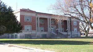
Kiowa County is one of the 64 counties in the state of Colorado. Based on the 2010 census, the population was 1,398, making it the fifth-least populous county in Colorado. The county seat is Eads. Kiowa County was created on April 4, 1889 from Bent county. The county is named for the Kiowa Nation of Native Americans.
Etymology - Origin of Kiowa County Name
Kiowa county was named for the Kiowa Nation of Native Americans.
Demographics:
County QuickFacts: CensusBureau Quick Facts
Kiowa County History
Kiowa County is the second least densely populated of the 64 counties of the State of Colorado of the United States. The county population was 1,622 at the 2000 census. The county seat is Eads. The county was named for the Kiowa Nation of Native Americans.
On November 29, 1864, more than a decade before Colorado became a state and long before Kiowa County was formed, a massacre of Native Americans, a group of old men, women, and children, occurred on Sand Creek that initially was greeted as a victory in the
Colorado War against hostile Indians; within months, Congressional inquiries revealed the truth, and a national scandal erupted. It happened in what is now Kiowa County, and is known as the Sand Creek Massacre.
Territorial Governor John Evans eventually lost his job for his part in setting up the incident, and Colonel John Chivington, commander of the US forces, was
chastised by the United States Congress and the scandal followed him for the rest of his life. Evans would go on to make significant
important contributions to the early Denver community and while Chivington also made some, his reputation remained tainted while Evans is still honored today.
In the late 1880s, eastern Colorado attracted a lot of attention by farming interests who didn't yet know that long-term agriculture was unsustainable in this arid landscape, and the railroads were snaking west across the plains towards the gold fields of the Rocky Mountains during the Colorado Gold
Rush. The Missouri Pacific Railroad crossed into what would soon become Kiowa County, Colorado from Kansas in 1887.
Several small camps for railroad workers were established just over the border from Kansas, and beginning after the town of Sheridan Lake, new towns and camps were sequentially named, alphabetically, starting with "A" and proceeding westward along the
railroad line.
Arden, Brandon, Chivington, Diston, Eads, Fergus, Galatea, Haswell, Inman, Joliet, and Kilburn appeared one after another, some developing into towns, others being only a pipe dream in the eyes of developers. Chivington was intended as a major watering stop for the railroad (a 60-room, $10,000
"crown jewel" hotel was initially built there), but the water was too alkaline to use and the trains instead stopped in Kansas to tank up. The hotel was soon torn down, its materials shipped to other Colorado locations to use in constructing other facilities - a common occurrence in late 19th
century Colorado, as boom towns went bust.
Kiowa County was established in 1889, taking its name from the Kiowa Indians who lived in eastern Colorado before the Europeans arrived. Sheridan Lake was the county seat of Kiowa County, and was not at first a stop on the railroad line; only after local citizens built a railroad depot and turned it
over to the Missouri Pacific did the railroad build a telegraph station and make Sheridan Lake a stop. The county seat moved to rival Eads in 1902.
Agriculture in eastern Colorado collapsed in the dust bowl days of the 1930s, today mostly dry-land farms and some ranching interests survive. Colorado's Front Range cities and agriculture interests upstream have acquired most of the water rights, and the groundwater
aquifers are drying up; Kiowa County faces ever-decreasing water supplies and further economic decline.
In 2005, final land acquisitions by the National Park Service
allowed official designation of the Sand Creek Massacre National
Historic Site, but no park facilities have yet been erected. Only a
plaque in the ground acknowledges the site, and it appears that this
stone plaque is located in the wrong place.
Today only Eads along the old railroad line remains as a town of much significance, Eads is the Kiowa county seat and serves the surviving farming and ranching interests, and hosts the county's largest high school. Sheridan Lake does have a combined junior-and-senior high, and still surviving in
some form are Towner, Arlington, Brandon, Chivington, and Haswell.
Geography: Land and Water
As reported by the Census Bureau, the county has a total area of 1,786 square miles (4,625 km2), of which, 1,771 square miles (4,587 km2) of it is land and 15 square miles (38 km2) of it (0.83%) is water.
Kiowa County is located on the eastern edge of Colorado. The open
spaces makes Kiowa County a perfect place for outdoor activity. From
camping to hunting to wildlife watching. South of Haswell is Adobe
Creek Reservoir or 'Blue Lake'.
Neighboring Counties
Bordering counties are as follows:
- Northeast: Cheyenne County
- East: Greeley County, Kan.
- Southeast: Hamilton County, Kan.; Prowers County
- Southwest: Bent County; Otero County
- West: Crowley County
- Northwest: Lincoln County
Education


Click Image to Enlarge
