


Click Image to Enlarge
Colorado Counties
Colorado currently has sixty-four counties. In February 1866, the first new county, Las Animas, was created. Alamosa was created in 1913, and in 2001, Broomfield was recognized as a city-county, bringing a total of 64 counties.Logan County, Colorado
Logan County Education, Geography, and History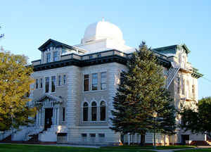
Logan County is one of the 64 counties in the state of Colorado. Based on the 2010 census, the
population was 22,709.[ The county
seat is
Sterling. Logan County was established on February 25,
1887 from Weld County. The county is named for General John A. Logan.
Logan County comprises the Sterling, CO Micropolitan Statistical Area
Etymology - Origin of Logan County Name
Logan County is named in honor of John Alexander Logan, a general in the American Civil War and United States Senator.
Demographics:
County QuickFacts: CensusBureau Quick Facts
Logan County History
Logan County was created in 1887 from part of Weld County. In 1889 the eastern part was split off to form Phillips and Sedgwick Counties.
Geography: Land and Water
As reported by the Census Bureau, the county has a total area of 1,845 square miles (4,778 km2), of which, 1,839 square miles (4,762 km2) of it is land and 6 square miles (16 km2) of it (0.34%) is water.
Logan county is located in the northeast corner of Colorado. The
American Discovery Trail, Pawnee Pioneer Trails and South Platte Trail
are located in Logan county.
Neighboring Counties
Bordering counties are as follows:
- North: Cheyenne County, Neb.
- Northeast: Sedgwick County
- East: Phillips County
- Southeast: Yuma County
- South: Washington County
- Southwest: Morgan County
- West: Weld County
- Northwest: Kimball County, Neb.
Education


Click Image to Enlarge
