


Click Image to Enlarge
Colorado Counties
Colorado currently has sixty-four counties. In February 1866, the first new county, Las Animas, was created. Alamosa was created in 1913, and in 2001, Broomfield was recognized as a city-county, bringing a total of 64 counties.Sedgwick County, Colorado
Sedgwick County Education, Geography, and History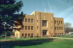
Sedgwick County is the northeastern most of the 64 counties in the state of Colorado. Based on the 2010 census, the population was 2,379. The county seat is Julesburg. Sedgwick County was created on April 9, 1889 from Logan County. The county is named for Fort Sedgwick, a military post along the Platte Trail, which was named for General John Sedgwick.
Etymology - Origin of Sedgwick County Name
Sedgwick County is named for Fort Sedgwick, which, in turn, was named for US Army General John Sedgwick.
Demographics:
County QuickFacts: CensusBureau Quick Facts
Sedgwick County History
Sedgwick County was created in 1889 from part of Logan County.
Geography: Land and Water
As reported by the Census Bureau, the county has a total area of 550 square miles (1,423 km2), of which, 548 square miles (1,420 km2) of it is land and 1 square miles (4 km2) of it (0.25%) is water.
Sedgwick county is located in northeast Colorado. The American Discovery Trail, First Transcontinental Railroad, Pony Express National Historic Trail, South Platte River Trail, Scenic and Historic Byway, and South Platte Trail are located in Sedgwick county.
Neighboring Counties
Bordering counties are as follows:
- North: Deuel County, Neb.
- Northeast: Keith County, Neb.
- East: Perkins County, Neb.
- South: Phillips County
- Southwest: Logan County
- Northwest: Cheyenne County, Neb.
Education


Click Image to Enlarge
