


Click Image to Enlarge
Colorado Counties
Colorado currently has sixty-four counties. In February 1866, the first new county, Las Animas, was created. Alamosa was created in 1913, and in 2001, Broomfield was recognized as a city-county, bringing a total of 64 counties.Yuma County, Colorado
Yuma County Education, Geography, and History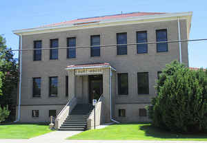
Yuma County is one of the 64 counties of the state of Colorado. Based on the 2010 census, the population was 10,043. The county seat is Wray. Yuma County was created on March 15, 1889 from Washington County. The county is named after Quechan (Yuma) Nation of Native Americans.
Etymology - Origin of Yuma County Name
Yuma County is named for the Yuma Native American tribe.
Demographics:
County QuickFacts: CensusBureau Quick Facts
Yuma County History
Yuma County was created in 1889 from part of Washington County. The south half of Yuma County was added in 1903 from Arapahoe County.
Geography: Land and Water
As reported by the Census Bureau, the county has a total area of 2,369 square miles (6,136 km2),
of which, 2,366 square miles (6,127 km2) of it is land and 3 square miles (9 km2) of it is water. The
total area is 0.14% water.
Yuma county is located in east Colorado.
The point where the Arikaree River flows out of Yuma County and into Cheyenne County, Kansas is the
lowest point in the State of Colorado, at 3,315 feet elevation. This crossing point holds
the distinction of being the highest low point of any United States.
Neighboring Counties
Bordering counties are as follows:
- North: Phillips County
- Northeast: Chase County, Neb.; Dundy County, Neb.
- Southeast: Cheyenne County, Kan.; Sherman County, Kan.
- South: Kit Carson County
- West: Washington County
- Northwest: Logan County
Education


Click Image to Enlarge
