

Click Image to Enlarge
Washington, DC
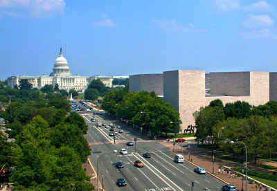
Washington, DC formally, the District of Columbia and commonly referred to as Washington, the District, or simply DC) is the capital of the United States, founded on July 16, 1790.District of Columbia: History and Information
Find a brief history of District of Columbia
Washington, D.C. formally, the District of Columbia and commonly referred to as Washington, the District, or simply D.C.) is the capital of the United States, founded on July 16, 1790. The City of Washington used to be a separate municipality within the District of Columbia until the Organic Act of 1871, Congress created a new government for the entire federal territory. This Act effectively combined the City of Washington, Georgetown, and Washington County into a single municipality officially named the District of Columbia. It is for this reason that the city, while legally named the District of Columbia, is known as Washington, D.C. The city is located on the north bank of the Potomac River and is bordered by the states of Virginia to the southwest and Maryland to the other sides.
Article One, Section Eight of the United States Constitution provides for a federal district, distinct from the states, to serve as the permanent national capital. The centers of all three branches of the federal government of the United States are located in the District
The United States Congress has supreme authority over Washington, D.C.; residents of the city therefore have less self-governance than residents of the states. The District has a non-voting at-large Congressional delegate, but no senators.
Demographics:
County QuickFacts: Census Bureau Quick Facts
Find a brief history of District of Columbia |
||||
|---|---|---|---|---|
| County | 2000 Population |
Square Miles |
County Seat | Created |
| District Of Columbia | 572,059 | 61 | Washington | 1790 |
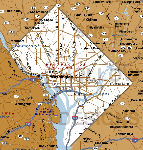
Geography of District of Columbia
The Chesapeake and Ohio Canal passes through the Georgetown neighborhood. Washington, D.C. has a total area of 68.3 square miles (177 km2), of which
61.4 square miles (159 km2) is land and 6.9 square miles (18 km2) (10.16%) is water. The District is no longer 100 square miles (260 km2) due to the
retrocession of the southern portion of the District back to the Commonwealth of Virginia in 1846. The District's current area consists only of territory
ceded by the state of Maryland.

Click Image to Enlarge
