


Click Image to Enlarge
Georgia Counties
Georgia is divided into one hundred and fifty-nine counties. The original eight counties of the State of Georgia were Burke, Camden, Chatham, Effingham, Glynn, Liberty, Richmond and Wilkes all created on February 5, 1777. The last new county to be established in Georgia was Peach County, established in 1924.Clay County, Georgia
Clay County Education, Geography, and History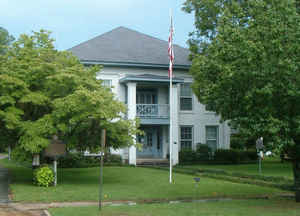
Clay County is a county located in the state of Georgia. Based on the 2010 census, the population was 3,183, making it the fifth-least populous county in Georgia. Clay County was created on February 16, 1854 from Early County and Randolph County. The county seat is Fort Gaines. The county is named in honor of Henry Clay (1777 - 1852), the Secretary of State, the Speaker of the House of Representatives, and a US Senator from Kentucky.
Etymology - Origin of Clay County Name
The county is named for Senator Henry Clay of Kentucky.
Demographics:
County QuickFacts: CensusBureau Quick Facts
Clay County History
Clay County was created from parts of Early and Randolph counties in 1854. It was named for Senator Henry Clay of Kentucky.
Fort Gaines grew up around a fort on the Chattahoochee River established to protect settlers during the Creek Indian Wars. The town, named for the fort's builder, General Edmund Pendleton Gaines, became a shipping point for cotton planters for many miles on both sides of the Chattahoochee River,
remaining a key market until about 1858 when railroads replaced river freight.
Cemocheechobee Creek is the site of a pre-historic community, consisting of a large village area surrounding three adjacent platform mounds.
Points of Interest
The Walter F. George Lock and Dam in George T. Bagby State Park is just north of Fort Gaines on the Chattahoochee River. Under construction from 1955 until 1963, the dam stretches two and a half miles from Alabama. The lock, second highest east of the Mississippi, forms a lake called Lake Walter
F. George . The lake extends 85 miles upriver.
The Fort Gaines Historic District and Frontier Village are tourist attractions. There are several reconstructed fort buildings on the site of the original Fort Gaines, and two Civil War gun emplacements. There are also the remains of an 1890s cottonseed oil mill and an early 20th century waterworks.
All of these sites are on the National Register.
Elizabeth Stuart Dill who was captured and held hostage by Indians after the War of 1812, is one of the county's interesting historical figure. Forced to accompany the Indians on their raids, she was able to gather a lot of paper money that the Indians had deemed useless and save it by pinning it to
her petticoats. When rescued, she returned with her loot to Fort Gaines and built the Dill House, which is now a Bed and Breakfast.
Other recreational facilities include the Meadowlinks 18-Hole Championship Golf Course.
Notable Citizens
Walter F. George, a notable Clay County resident, rose from tenant farmer beginnings to serve in the US Senate from 1923 to 1956. President Eisenhower also appointed George to be his personal ambassador to NATO.
Geography: Land and Water
As reported by the Census Bureau, the county has a total area of 217 square miles (560 km2), of which 195 square miles (510 km2) is land and 22 square miles (57 km2) (10.1%) is water.
Clay county is located in southwest Georgia. Clay is in the Flint River basin and the Chattahoochee River basin.
Neighboring Counties
Bordering counties are as follows:
- North: Quitman County
- Northeast: Randolph County
- Southeast: Calhoun County
- South: Early County
- Southwest: Henry County, Ala.
- Northwest: Barbour County, Ala.
Education


Click Image to Enlarge
