


Click Image to Enlarge
Georgia Counties
Georgia is divided into one hundred and fifty-nine counties. The original eight counties of the State of Georgia were Burke, Camden, Chatham, Effingham, Glynn, Liberty, Richmond and Wilkes all created on February 5, 1777. The last new county to be established in Georgia was Peach County, established in 1924.Lanier County, Georgia
Lanier County Education, Geography, and History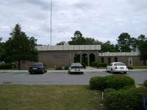
Lanier County is a county located in the state of Georgia. Based on the 2010 census, the
population was 10,078. Lanier County was
created on August 7, 1920. The county seat and only
incorporated municipality is Lakeland. The county is named after the Georgia poet Sidney Lanier.
Lanier County is part of the Valdosta, GA Metropolitan Statistical Area. Lanier shares Moody Air Force Base with Lowndes County on its western
boundary.
Etymology - Origin of Lanier County Name
The county was named in honor of Georgia state poet, Sidney Lanier.
Demographics:
County QuickFacts: CensusBureau Quick Facts
Lanier County History
Lanier County, the 155th county formed in Georgia, was created in 1920. The county was named in honor of Georgia state poet, Sidney Lanier.
Lakeland, the county seat, is Lanier County's only incorporated municipality. Originally called Mill Town, Lakeland received its current name in 1925 in honor of its proximity to several lakes including Grand Bay Lake, Lake Irma and Banks Lake.
Points of Interest
For many years, Lakeland owned and operated its own railroad.
The county is famous for its excellent fishing in the Alapaha River, as well as in its many small lakes. Banks Lake Wildlife Refuge, which includes a 3,900-acre lake, is located in the county.
Lanier shares Moody Air Force Base with Lowndes County on its western boundary.
Notable Citizens
One notable person from Lanier County was Eurith Dickinson "Ed" Rivers, a Georgia governor and speaker of the Georgia House. He was a strong proponent of the "New Deal" and an outspoken opponent of Eugene Talmadge.
Geography: Land and Water
As reported by the Census Bureau, the county has a total area of 200 square miles (520 km2), of which 185 square miles (480 km2) is land and 15 square miles (39 km2) (7.3%) is water.
Lanier county is located in south Georgia. The county is in the Suwannee River basin.
Neighboring Counties
Bordering counties are as follows:
- Northeast: Atkinson County
- Southeast: Clinch County; Echols County
- Southwest: Lowndes County
- Northwest: Berrien County
Education


Click Image to Enlarge
