


Click Image to Enlarge
Georgia Counties
Georgia is divided into one hundred and fifty-nine counties. The original eight counties of the State of Georgia were Burke, Camden, Chatham, Effingham, Glynn, Liberty, Richmond and Wilkes all created on February 5, 1777. The last new county to be established in Georgia was Peach County, established in 1924.Taylor County, Georgia
Taylor County Education, Geography, and History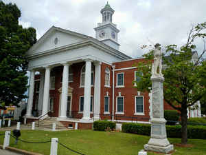
Taylor County is a county located in the west central portion of the state of Georgia. Based on the 2010 census, the population was 8,906. Taylor County was created on January 15, 1852. The county seat and largest city is Butler. The county is named in honor of Zachary Taylor (1784-1850), the twelfth President of the United States.
Etymology - Origin of Taylor County Name
The county was named after Zachary Taylor, who won a victory at Buena Vista in the Mexican War and later became the 12th President of the United States.
Demographics:
County QuickFacts: CensusBureau Quick Facts
Taylor County History
Taylor County was created from Macon, Marion and Talbot counties in 1852, the 98th county organized. The county was named after Zachary Taylor, who won a victory at Buena Vista in the Mexican War and later became the 12th President of the United States.
The Tuscaloosa Formation, located in the county, is a sand clay formation that represents the first prominent coastal plains deposits laid.
Butler was named for General William Orlando Butler, another hero of the Mexican War.
Points of Interest
The Wire Road, which ran through Taylor County, was named for the telegraph wire that stretched along it. The road was part of the stage highway from Richmond to New Orleans.
Points of interest in Taylor County include: Beechwood Farm, the home of Confederate General John B. Gordon; and the site of Fort Lawrence, which was established by Colonel Benjamin Hawkins, for whom Hawkinsville was named.
Geography: Land and Water
As reported by the Census Bureau, the county has a total area of 380 square miles (980 km2), of which 377 square miles (980 km2) is land
and 3.0 square miles (7.8 km2) (0.8%) is water.
Taylor county is located close to the center of Georgia.
The county is dissected by the Fall Line geological formation. The upper half of the county is located in the Piedmont region and consists
of gently rolling hills and clay-based soils. The lower half of the county is located in the Upper Atlantic Coastal Plain and is markedly
flatter and the soil more sandy. The Flint River marks the entirety of the county's northeastern border.
Neighboring Counties
Bordering counties are as follows:
- North: Upson County
- Northeast: Crawford County
- East: Peach County
- Southeast: Macon County
- South: Schley County
- Southwest: Marion County
- Northwest: Talbot County
Education


Click Image to Enlarge
