


Click Image to Enlarge
Indiana Counties
Indiana is divided into ninety-two counties. The oldest and newest Counties in Indiana are Knox County (created 1790) and Newton County (created 1857).Many Indiana counties are named for the US Founding Fathers and personalities of the American Revolutionary War, the War of 1812 and Battle of Tippecanoe; early leaders of Indiana Territory and Indiana, as well as surrounding states like Michigan and Kentucky; plus Native American tribes and geographical features.Dubois County, Indiana
Dubois County Education, Geography, and History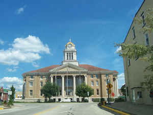
Dubois County is a county located in the state of Indiana. As of 2010, the
population was 41,889. Dubois County was
created on February 1, 1818. The county
seat is Jasper. The county is named
for Toussaint Dubois, hero of the Battle of Tippecanoe and the War of
1812.
Dubois County is part of the Jasper Micropolitan Statistical Area.
Etymology - Origin of Dubois County Name
The county is named for Captain Toussaint DuBois who served as head of the guards and spies in the Tippecanoe Campaign under General William Henry Harrison.
Demographics:
County QuickFacts: CensusBureau Quick Facts
Dubois County History
Dubois County was organized by Legislative act December 18, 1817, which became effective February 1, 1818. It
is named for Toussaint Dubois, a Frenchman who fought in the Revolutionary War, the Battle of Tippecanoe and the War of
1812. DuBois was a merchant who lived mainly in Vincennes. He drowned in 1816 while crossing the Little Wabash River
near Lawrenceville, Illinois.
Dubois County switched to the Central Time Zone on April 2, 2006, and returned to the Eastern Time Zone on November 4,
2007; both changes were controversial.
The original county seat was Portersville. In 1830 the county seat was moved south to Jasper.
Dubois County is divided into 12 Civil Townships as follows: Bainbridge, Boone, Cass, Columbia, Ferdinand, Hall, Harbison, Jackson, Jefferson, Madison, Marion and Patoka.
Geography: Land and Water
As reported by the Census Bureau, the county has a total area of 435 square miles (1,127 km2), of which 430 square miles (1,114 km2) is land and 5 square miles (13 km2) (1.18%) is water.
Dubois county is located in south Indiana.
Neighboring Counties
Bordering counties are as follows:
- North: Martin County
- Northeast: Orange County
- East: Crawford County
- Southeast: Perry County
- Southwest: Spencer County; Warrick County
- West: Pike County
- Northwest: Daviess County
Education
Public education in Dubois County is administered through four school corporations:
Greater Jasper Consolidated Schools
Southeast Dubois School Corporation
Southwest Dubois School Corporation
Northeast Dubois County School Corporation
High Schools
Jasper High School (Greater Jasper Schools, Jasper)
Forest Park High School (Southeast Dubois Schools, Ferdinand)
Southridge High School (Southwest Dubois Schools, Huntingburg)
Northeast Dubois High School (Northeast Dubois Schools, Dubois)


Click Image to Enlarge
