


Click Image to Enlarge
Nebraska Counties
There is ninety-three counties in state of Nebraska. Despite the fact that Sarpy County contained the oldest settlement in the state, it was one of the last lands along the river to be recognized by law. Finally, on February 1, 1857, the land "where the cities meet the country" was officially created.Cedar County, Nebraska
Cedar County Education, Geography, and History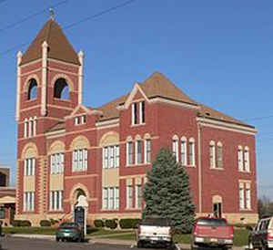
Cedar County is a county located in the state of Nebraska. Based on the 2010 census, the population was 8,852. Its county seat is Hartington. The county was formed in 1857 and named for the great number of cedars that grow there.
Etymology - Origin of Cedar County Name
Namedas such because of the number of cedar trees that were growing in the area
Demographics:
County QuickFacts: CensusBureau Quick Facts
Cedar County History
According to historians, three
communities in Cedar County can claim a distant link to British royalty. As the
story goes, Coleridge was named after Lord Coleridge, Randolph was named in
honor of Lord Randolph Churchill, and the county seat of Hartington received its
name as a tribute to Lord Hartington. All three Britons had visited the United
States about the time the townsites were being established.
The history of this area in Northeast Nebraska can be traced back to the 1650s
when the Omaha Indians lived along the Bow Creek area. For the next 90 years
this area that borders the Missouri River on the north was home to the Omaha,
Ponca and Sioux tribes. An occasional trapper or trader would pass through the
area, but it was in 1804 with the exploration of Meriwether Lewis and William
Clark that the area was first made known to the white man.
The Kansas-Nebraska Act of 1854 opened the territory to white settlers for the
first time. Three years later Cedar County was organized by an act of the
Territorial Legislature. The boundaries of the county, which was named as such
because of the number of cedar trees that were growing in the area, were
redefined in 1860 to their present dimensions.
Cedar County has had three county seats. The first was located in Old St. James,
where a two-story frame courthouse was constructed. In 1858 the settlement of
St. Helena, along the Missouri River, was established. Three years later,
through an election, the county seat was moved to this settlement and would
remain there until 1885. In the meantime, the townsite of Hartington was growing
and in 1885 it was declared the county seat following an election. That same
year bonds were approved for the construction of a courthouse. The decision to
move the seat of local government to Hartington was made primarily because its
central location was more accessible to the growing number of county residents.
Once covered by prairies grass, the county today is known for its farming and
livestock production.
Geography: Land and Water
As reported by the Census Bureau, the county has a total area of 746 square miles (1,930 km2), of which 740 square miles (1,900 km2) is
land and 5.5 square miles (14 km2) (0.7%) is water.
Neighboring Counties
Bordering counties are as follows:
- Clay County, South Dakota - northeast
- Dixon County, Nebraska - east
- Wayne County, Nebraska - southeast
- Pierce County, Nebraska - southwest
- Knox County, Nebraska - west
- Yankton County, South Dakota - northwest
Education


Click Image to Enlarge
