Nebraska Counties
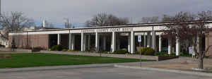
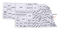
There is ninety-three counties in state of Nebraska. Despite the fact that Sarpy County contained the oldest settlement in the state, it was one of the last lands along the river to be recognized by law. Finally, on February 1, 1857, the land "where the cities meet the country" was officially created.Cheyenne County, Nebraska
Cheyenne County Education, Geography, and History
Cheyenne County is a county located in the state of Nebraska. Based on the 2010 census, the population was 9,998. Its county seat is Sidney. The county was formed in 1871 and named after the Cheyenne Native American tribe.
Etymology - Origin of Cheyenne County Name
Cheyenne
Demographics:
County QuickFacts: CensusBureau Quick Facts
Cheyenne County History
The development of Cheyenne County
can be attributed to early America's desire to move westward. The Oregon and
Mormon Trails brought scores of setters through the area in the 1840s, while the
advancement of the Union Pacific Railroad 20 years later provided an even
greater contribution.
Although the two famous trails actually flanked the area that today is Cheyenne
County, many early pioneers followed Lodgepole Creek from Julesburg, Colo., to
the site of present day Sidney, then turned north to connect with the Mormon
Trail. The Pony Express would also follow the Lodgepole Creek route.
In 1867, when the Union Pacific pushed toward the Wyoming border, the southern
part of the county began to develop more rapidly. Sidney was laid out as a
division point and became home to a US Army infantry company assigned to
protect the railroaders. The Army's presence also benefited the growing number
of cattle ranchers who had come to the area.
Cheyenne County was actually created in June 1871. The county was literally the
southern half of the Panhandle. In 1888, the western third was divided to create
Kimball, Banner and Scotts Bluff Counties, while the eastern third became Deuel
County. Twenty years later, in 1908, the northern portion was designated as
Morrill County.
With heavy traffic along the trails and on the railroad, Sidney experienced a
wild era. Raucous behavior and a growing number of robberies prompted increased
military protection for the area and resulted in the Sidney Barracks, which
became Fort Sidney. World War II brought to the county the Sioux Ordnance Depot,
a 19,000-acre munitions storage facility northwest of Sidney. This construction
led to an economic boom in the 1940s, as did the drilling of the first
successful oil well in the area.
Today, America's east-west travel still contributes to the area's growth. This
time it is thanks to Interstate 80. Agriculture and cattle production are keys
to the county's economy.
Geography: Land and Water
As reported by the Census Bureau, the county has a total area of 1,196 square miles (3,100 km2), of which 1,196 square miles (3,100 km2)
is land and 0.1 square miles (0.26 km2) (0.01%) is water
Neighboring Counties
Bordering counties are as follows:
- Morrill County, Nebraska - north
- Garden County, Nebraska - northeast
- Deuel County, Nebraska - east
- Sedgwick County, Colorado - southeast
- Logan County, Colorado - south
- Kimball County, Nebraska - west
- Banner County, Nebraska - northwest
Education


