


Click Image to Enlarge
Nebraska Counties
There is ninety-three counties in state of Nebraska. Despite the fact that Sarpy County contained the oldest settlement in the state, it was one of the last lands along the river to be recognized by law. Finally, on February 1, 1857, the land "where the cities meet the country" was officially created.Dawson County, Nebraska
Dawson County Education, Geography, and History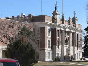
Dawson County is a county located in the state of Nebraska. Based on the 2010 census, the population was 24,326. Its county seat is
Lexington.
Dawson County is part of the Lexington, NE Micropolitan Statistical Area.
Etymology - Origin of Dawson County Name
It was named in honor of Jacob Dawson, who was the first postmaster in the settlement of Lancaster, the forerunner to the state's capital city.
Demographics:
County QuickFacts: CensusBureau Quick Facts
Dawson County History
Dawson County created quite a bit of
excitement in 1873, not only in Nebraska but also across the country. It was
reported that year that gold had been discovered about 1? miles east of the
settlement of Plum Creek. As word spread, gold seekers flocked to the area in
search of their fortunes. The pieces of metal that had been dug up were later
determined not to be gold and those that came to the area in hopes of find great
wealth went away empty handed.
The county's original boundaries were established by the Territorial Legislature
in 1860. A proclamation signed by acting Gov. William James in 1871 officially
organized the county. It was named in honor of Jacob Dawson, who was the first
postmaster in the settlement of Lancaster, the forerunner to the state's capital
city.
Ten years before the county was organized, a telegraph line was located through
the area. Small settlements and ranches quickly sprang up every few miles along
the line. The most significant of these early settlements was called Plum Creek,
on the Overland Trail along the south bank of the Platte River. As a telegraph
and stage coach station, Plum Creek became an important stopping point between
Fort Kearny and Fort McPherson. Within a short time the Union Pacific Railroad
passed through the area.
Plum Creek was the primary settlement of the county. A post office, school and
churches were built in the early 1870s. The most important construction project,
however, may have been a bridge built across the Platte River. Since the only
other bridge across the river was located about 150 miles to the east, the Plum
Creek bridge further opened the area to settlers.
Plum Creek continued to grow and in 1886 it was incorporated. Three years later
the residents held a town meeting and decided to rename the community in honor
of a famous battle that occurred during the Civil War. From that point on, the
county seat of Dawson County would be known as Lexington.
Geography: Land and Water
As reported by the Census Bureau, the county has a total area of 1,019 square miles (2,640 km2), of which 1,013 square miles (2,620 km2)
is land and 6.3 square miles (16 km2) (0.6%) is water
Neighboring Counties
Bordering counties are as follows:
- Buffalo County (east)
- Phelps County (southeast)
- Gosper County (south)
- Frontier County (southwest)
- Lincoln County (west)
- Custer County (north)
Education


Click Image to Enlarge
