


Click Image to Enlarge
Nebraska Counties
There is ninety-three counties in state of Nebraska. Despite the fact that Sarpy County contained the oldest settlement in the state, it was one of the last lands along the river to be recognized by law. Finally, on February 1, 1857, the land "where the cities meet the country" was officially created.Holt County, Nebraska
Holt County Education, Geography, and History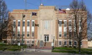
Holt County is a county located in the state of Nebraska. Based on the 2010 census, the population was 10,435.Its county seat is O'Neill.
Holt County is located in the Outback area of Nebraska.
Etymology - Origin of Holt County Name
Named after American statesman Joseph Holt
Demographics:
County QuickFacts: CensusBureau Quick Facts
Holt County History
Each year the residents of Holt
County celebrate with great pride their Irish ancestry and the role it played in
the development of the county. In fact, O'Neill, the county seat, is oftentimes
referred to as the Irish Capital of Nebraska.
The Irish heritage in the county dates back more than 122 years. Ten years after
the county's boundaries were established in 1862, Gen. John O'Neill conceived a
plan to bring his Irish countrymen out of the crowded East and to the land of
"Room Enough." O'Neill traveled through Minnesota, Wisconsin, Iowa, Illinois,
Missouri and Nebraska seeking a suitable site. He decided on Holt County, which
had been named after American statesman Joseph Holt. O'Neill brought groups of
Irish immigrants to the area each year beginning 1864 and continuing through
1867. O'Neill's efforts are credited for the county's early development.
The first attempts to organize Holt County were made in 1873. However, the area
did not have the required 200 inhabitants at that time. A second effort was made
three years later and a governor's proclamation was issued that June. In the
election that followed in August, a settlement named Twin Lakes was made the
county seat. Canvassing the vote became so difficult that the election was
declared invalid and another election was held in December. This time the
village of Paddock was named the county seat.
Since Paddock was located on the extreme north edge of the county,
dissatisfaction grew and a special election was held in 1879 to relocate the
county seat to a more central location. O'Neill was chosen. It would not be
until 1885 that a courthouse was built. Between 1888 and 1904 at least five
attempts were made to move the seat of government again. All failed.
Today, O'Neill is known as the gateway to the Sandhills, with livestock feeders
and farmers on the east and ranchers to the west. The area is one of the leading
hay producers in the state. Because of the abundance of water sources in the
county, irrigated corn is its most prevalent farm crop.
Geography: Land and Water
As reported by the Census Bureau, the county has a total area of 2,417 square miles (6,260 km2), of which 2,412 square miles (6,250 km2) is land and 5.1 square miles (13 km2) (0.2%) is water. It is the fifth-largest county in Nebraska by area.
Neighboring Counties
Bordering counties are as follows:
- Boyd County - north
- Knox County - east
- Antelope County - southeast
- Wheeler County - south
- Garfield County - south
- Loup County - southwest
- Rock County - west
- Keya Paha County - northwest
Education

e

Click Image to Enlarge
