Nebraska Counties
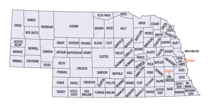
There is ninety-three counties in state of Nebraska. Despite the fact that Sarpy County contained the oldest settlement in the state, it was one of the last lands along the river to be recognized by law. Finally, on February 1, 1857, the land "where the cities meet the country" was officially created.Kimball County, Nebraska
Kimball County Education, Geography, and History
Kimball County is a county located in the state of Nebraska. Based on the 2010 census, the population was 3,821. Its county seat is Kimball. The county was formed in 1888 and named after railroad pioneer Thomas L. Kimball.
Etymology - Origin of Kimball County Name
Namedin honor of Thomas L. Kimball, vice president and general manager of the Union Pacific Railroad.
Demographics:
County QuickFacts: CensusBureau Quick Facts
Kimball County History
An election held Nov. 6, 1888 resulted in the western
third of Cheyenne County being split to form Kimball, Banner and Scotts Bluff
Counties. Following the election, Kimball County was organized and named in
honor of Thomas L. Kimball, vice president and general manager of the Union
Pacific Railroad.
As the railroad passed through this area in the 1860s, a settlement named
Antelopeville sprang up. It was named as such because of the prevalence of
antelope in the area. When attempts were made to recognize a post office as
Antelope, it was discovered there was already a post office in the state by that
name. So in 1885 the name of the townsite was changed to Kimball and it became
the county seat.
Kimball County possesses many distinctive features. It is home to the highest
elevation in the state - Panorama Point which is 5,424 feet and located in the
southwest corner of the county near where Nebraska, Colorado and Wyoming
intersect. At one time, Kimball County was home to the world's largest complex
of I.C.B.M. Minute Man missiles. This earned the county the title of "Missile
Center of the United States."
Another title worn by Kimball County was "Nebraska's Oil Capitol." In the early
1980s, more than 1,400 active wells were operating across the county.
In addition to the railroad, the Kincaid Act of 1904 was credited with bringing
many settlers to the area, primarily farmers. The native buffalo and gramma
grass made cattle feeding a natural for the Kimball County area, while the rick,
black loam soil proved good for farming.
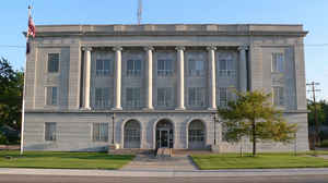
Kimball County has had two courthouses. The first was built in 1890 and was used
until 1928. In addition to housing the offices of local government, the building
was the scene of many of the county's social activities. In 1928 the current
courthouse opened. Built of Carthage stone, with floors of Ozark gray marble and
fixtures made of solid walnut, the courthouse cost $180,000.
Geography: Land and Water
As reported by the Census Bureau, the county has a total area of 952 square miles (2,470 km2), of which 952 square miles (2,470 km2) is
land and 0.6 square miles (1.6 km2) (0.06%) is water.
The highest natural point in Nebraska, Panorama Point at 5,424 feet (1,653 m), is located in Kimball County.
Neighboring Counties
Bordering counties are as follows:
- Banner County - north
- Cheyenne County - east
- Logan County, Colorado - southeast
- Weld County, Colorado - southwest
- Laramie County, Wyoming - west
Education


