


Click Image to Enlarge
Nebraska Counties
There is ninety-three counties in state of Nebraska. Despite the fact that Sarpy County contained the oldest settlement in the state, it was one of the last lands along the river to be recognized by law. Finally, on February 1, 1857, the land "where the cities meet the country" was officially created.Merrick County, Nebraska
Merrick County Education, Geography, and History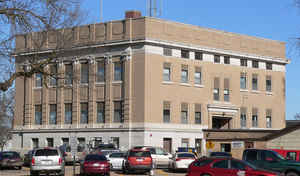
Merrick County is a county located in the state of Nebraska. Based on the 2010 census, the population was 7,845.
Merrick County was formed in 1858 and later organized in 1864. Merrick's county seat is
Central City. The county was named for Elvira Merrick, the maiden name of the wife of territorial legislator Henry W. DePuy.
Merrick County is part of the Grand Island, NE Metropolitan Statistical Area.
Etymology - Origin of Merrick County Name
The county was named in honor of Elvira Merrick, the maiden name of the wife of territorial legislator Henry W. DePuy of Dodge County, who introduced the bill creating the county
Demographics:
County QuickFacts: CensusBureau Quick Facts
Merrick County History
Merrick County could literally be
called a "panhandle" county, but not because of Nebraskans' general reference to
the 11 counties which are located in the state's Panhandle region. Rather, a
series of events at the time Merrick County's boundaries were created resulted
in the county having narrow "panhandles" on both the northwest and northeast
corners.
When the Legislature laid out the county in 1858, the northern boundary was a
straight line. The preceding year a reservation had been established for the
Pawnee tribe and Merrick County took in about half the reservation. As the
Pawnee tribe gradually moved to Oklahoma, the Legislature adopted an act to
create Nance County from the southern 180 square miles of reservation, all of
which were located within Merrick County. Since the Pawnees had wanted both
banks of the Loup River included in their reservation, the boundary line was
jogged to roughly parallel the Platte River. Thus, Merrick County today has a
jagged northern boundary, with narrow "panhandles" on both corners.
The county's history dates back to the pioneers who were headed west along the
Oxbow Trail. The Western State Company used this route to carry mail between
Omaha and Fort Kearny. It established a station about three miles southwest of
what today is Central City. Known as "Lone Tree Station" because of a lone
cottonwood tree, it became a welcome resting point for weary travelers.
When Merrick County was established, it was named in honor of Elvira Merrick,
wife of territorial legislator Henry W. DePuy of Dodge County. At the same time,
a settlement name Elvira was named the county seat. The advancement of the
railroad contributed much to the development of Central City, a town given this
name because it was centrally located in the agriculture region of the state.
With its development, Central City became the county seat and eventually Elvira
ceased to exist.
Before a courthouse was built in the 1870s, county offices were housed in the
residences of various officials.
Geography: Land and Water
As reported by the Census Bureau, the county has a total area of 494 square miles (1,280 km2), of which 485 square miles (1,260 km2) is
land and 9.6 square miles (25 km2) (1.9%) is water.
Neighboring Counties
Bordering counties are as follows:
- Platte County (northeast)
- Polk County (east)
- Hamilton County (south)
- Hall County (southwest)
- Howard County (west)
- Nance County (north)
Education


Click Image to Enlarge
