


Click Image to Enlarge
Nebraska Counties
There is ninety-three counties in state of Nebraska. Despite the fact that Sarpy County contained the oldest settlement in the state, it was one of the last lands along the river to be recognized by law. Finally, on February 1, 1857, the land "where the cities meet the country" was officially created.Nemaha County, Nebraska
Nemaha County Education, Geography, and History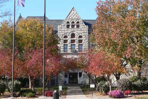
Nemaha County is a county located in the state of Nebraska. Based on the 2010 census, the population was 7,248. Its county seat is Auburn.
Etymology - Origin of Nemaha County Name
Another of Nebraska's counties that derives its name from Indian lore is Nemaha County. Years before the first white settlers, the Otoe Indians inhabited this area along the Missouri River. A stream which crossed the land and emptied into the Missouri was referred to by the Otoes as the miry water river. The Otoe name was Nimaha, ni meaning water and maha meaning miry. That name evolved into Nemaha.
Demographics:
County QuickFacts: CensusBureau Quick Facts
Nemaha County History
Nemaha County was originally called
Forney County, one of the eight original counties to make up the Nebraska
Territory. Forney County's boundaries were defined in October 1854. The
following year, in the first session of the Territorial Legislature, the county
was reorganized and its name changed to Nemaha.
In 1854, Richard W. Brown became one of the first pioneers in the area. Brown
crossed the Missouri River in a canoe and laid out a cabin claim along the west
bank. Within two years the town of Brownville was surveyed and platted. Brown's
original log cabin would serve as the county's courthouse until 1867.
There is an interesting history behind the present county seat of Auburn.
Originally there were two settlements here - Sheridan to the north and Calvert
to the south. Sheridan was surveyed in October 1868 and named in honor of Civil
War Gen. Phil S. Sheridan. Calvert was platted in July 1881 and named for Thomas
E. Calvert, an official with the Burlington and Missouri River Railroad. The two
rival towns agreed to unite and form one town in 1882. New York native Charles
Nixon, who had an interest in the land through which the railroad ran, suggested
the unified town be known as Auburn, after Auburn, N.Y.
According to historical accounts, a frame courthouse was built in the middle of
the two former towns. For many years this united town would be referred to as
North Auburn and South Auburn.
The original frame courthouse would soon be replaced when in 1900 the
cornerstone was laid for the present courthouse.
Geography: Land and Water
As reported by the Census Bureau, the county has a total area of 410 square miles (1,100 km2), of which 407 square miles (1,050 km2) is
land and 2.2 square miles (5.7 km2) (0.5%) is water.
Nemaha County is covered with rolling hills and farmland.
Most of the eastern border follows the Missouri River bordering Atchison County, Missouri. In the county's extreme northeast corner, the
border follows the river's former course, lying nearly two miles (3 km) east of the present-day channel. This de facto enclave is McKissick
Island.
Neighboring Counties
Bordering counties are as follows:
- Otoe County - north
- Atchison County, Missouri - east
- Holt County, Missouri - southeast
- Richardson County - south
- Pawnee County - southwest
- Johnson County - west
Education


Click Image to Enlarge
