


Click Image to Enlarge
Nebraska Counties
There is ninety-three counties in state of Nebraska. Despite the fact that Sarpy County contained the oldest settlement in the state, it was one of the last lands along the river to be recognized by law. Finally, on February 1, 1857, the land "where the cities meet the country" was officially created.Nuckolls County, Nebraska
Nuckolls County Education, Geography, and History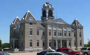
Nuckolls County is a county located in the state of Nebraska. Based on the 2010 census, the population was 4,500. Its county seat is Nelson.
Etymology - Origin of Nuckolls County Name
Nuckolls County is named in honor of the Nuckolls brothers. Lafayette Nuckolls, at age 19, became a member of the first Territorial Legislature while his brother, Stephen, was a pioneer Nebraska settler, businessman and banker.
Demographics:
County QuickFacts: CensusBureau Quick Facts
Nuckolls County History
Prior to being organized in 1871, the
area which today is Nuckolls County was the scene of some of the most fierce
Indian raids ever recorded in the south central portion of Nebraska. The largest
raid, recorded on Aug. 7, 1864, is said to have stretched from Gage County to
Denver. By 1867, the area was virtually abandoned. By the 1870s the situation
had greatly improved and settlers once again began to inhabit the area.
The Little Blue River, which passes through the northeast corner of the county,
led to much of the settlement that pre-dated the Indian raids. Mormons passed
through this area on their way to Salt Lake City. Thus the Oregon Trail was
created and in 1858 the government began using it for transporting supplies to
frontier military posts. The following year the Pony Express began following
this route.
E.S. Comstock is widely credited for the early development of this area. In 1856
Comstock established the first stage station at Oak, along the Little Blue
River. Eventually a post office and a Chicago and Northwestern Railroad station
were located in Oak. Following the Indian raids and subsequent return of the
settlers, the area began to prosper.
About this same time the county's boundaries were established by the
Legislature, although it was be another 11 years before the county was
officially organized. The county's first election was held June 21, 1871 under a
giant elm tree near the settlement of Oak. For the next several years, all
county business would be conducted from the home of D.W. Montgomery, who had
been elected surveyor. In 1874, as the population began to spread over the
county, voters selected Nelson as the county seat. Nelson, which was surveyed
only the year before, was located in the center of the county and was more
accessible to settlers.
Geography: Land and Water
As reported by the Census Bureau, the county has a total area of 576 square miles (1,490 km2), of which 575 square miles (1,490 km2) is
land and 0.7 square miles (1.8 km2) (0.1%) is water.
Neighboring Counties
Bordering counties are as follows:
- Clay County - north
- Fillmore County - northeast
- Thayer County - east
- Republic County, Kansas - southeast
- Jewell County, Kansas - southwest
- Webster County - west
Education


Click Image to Enlarge
