


Click Image to Enlarge
Nebraska Counties
There is ninety-three counties in state of Nebraska. Despite the fact that Sarpy County contained the oldest settlement in the state, it was one of the last lands along the river to be recognized by law. Finally, on February 1, 1857, the land "where the cities meet the country" was officially created.Scotts Bluff County, Nebraska
Scotts Bluff County Education, Geography, and History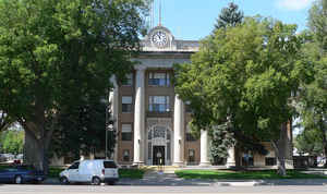
Scotts Bluff County is a county located on the western border of the state of Nebraska. Based on the 2010 census, the population was
36,970. Its county seat is Gering, and its largest city is Scottsbluff.
Scotts Bluff County is included in the Scottsbluff, NE Micropolitan Statistical Area.
Etymology - Origin of Scotts Bluff County Name
Scotts Bluff County is one of just two counties in Nebraska to
receive its name from a local landmark. In this case it is a towering bluff
located near the county seat of Gering. Known as the Scotts Bluff National
Monument, its history is significant to this area of the Panhandle.
The bluff was named after fur trapper Hiram Scott. History accounts indicate
that Scott was part of a trapping party headed up the North Platte River Valley.
When he and two other trappers became ill, they were left behind to return
downstream by boat. Along the way the boat capsized and the three, who lost all
supplies, began walking. Scott fell and broke his leg. Once again he was left
behind. The following spring Scott's skeleton was found at the foot the bluff
that bears his name. He had apparently crawled 75 miles before he died.
Demographics:
County QuickFacts: CensusBureau Quick Facts
Scotts Bluff County History
Scotts Bluff County was originally
part of the Louisiana Purchase and eventually part of Cheyenne County, which
made up the southern half of the Nebraska Panhandle when the state was admitted
to the Union in 1867. In an 1888 vote, Scotts Bluff County was formed. Gering,
which was founded the previous year, was named the county seat.
The Oregon Trail, Mormon Trail and Pony Express Route brought early travelers
and settlers to the area. But it was actually the railroads which spurred the
greatest growth. The Chicago, Burlington and Quincy was built through the
townsite of Scottsbluff in the early 1900s. It was not until 1911 that the Union
Pacific Railroad came to Gering. Despite the two communities being separated
only by the North Platte River, this fact resulted in Scottsbluff growing at a
faster pace. Today, Scottsbluff and Gering combine to serve as a central retail
hub for a 150-mile radius.
The lush North Platte River Valley that runs from northwest to southeast across
the county is prime crop production land. Principal crops today include sugar
beets, alfalfa, corn, pinto and northern beans, wheat and potatoes.
Additionally, livestock production is another vital part of the county's
economy.
Geography: Land and Water
As reported by the Census Bureau, the county has a total area of 745 square miles (1,930 km2), of which 739 square miles (1,910 km2) is
land and 6.0 square miles (16 km2) (0.8%) is water.
Neighboring Counties
Bordering counties are as follows:
- Sioux County (north)
- Box Butte County (northeast)
- Morrill County (east)
- Banner County (south)
- Goshen County, Wyoming (west)
Education


Click Image to Enlarge
