


Click Image to Enlarge
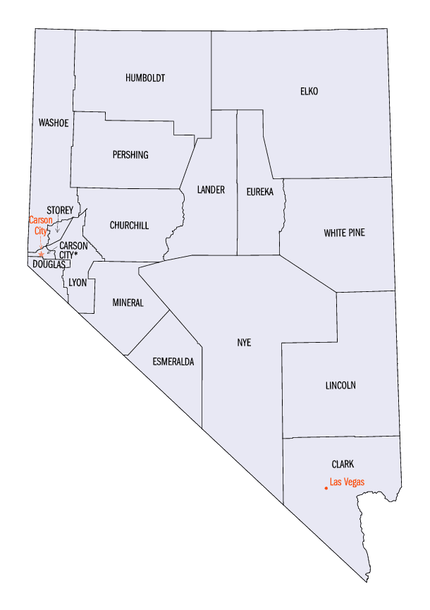
Nevada Counties
There are sixteen counties and one independent city in the state of Nevada. On November 25, 1861, the first Nevada Territorial Legislature established nine counties. Nevada was admitted to the Union on October 31, 1864 with eleven counties. In 1969, Ormsby County and Carson City were consolidated into a single municipal government known as Carson City.Lincoln County, Nevada
Lincoln County Education, Geography, and History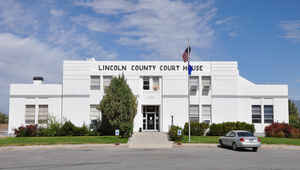
Lincoln County is a county located in the state of Nevada. Based on the 2010 census, the population was 5,345. Its county seat is Pioche.
Etymology - Origin of Lincoln County Name
It is named after Abraham Lincoln, the 16th President of the United States. Original legislation
called for the creation of a "Stewart County", after Nevada Senator William M. Stewart, however this was later changed in a substitute bill.
Demographics:
County QuickFacts: CensusBureau Quick Facts
Lincoln County History
February 25, 1866 - Once part of New Mexico territory, and once part of Arizona, was named in honor of Abraham Lincoln.
Lincoln County was established in 1866 after Congress enlarged Nevada by moving its state line eastward and southward at the expense of Utah
and Arizona territories. It is named after Abraham Lincoln, the 16th President of the United States. Original legislation called for the
creation of a "Stewart County", after Nevada Senator William M. Stewart, but this was later changed in a substitute bill. Crystal Springs was
the county's first seat in 1866, followed by Hiko in 1867, and Pioche in 1871 in honor of F. L. A. Pioche, a San Francisco banker/mine promoter.
Lincoln County initially included the town of Las Vegas. However, Clark County, Nevada, including Las Vegas, was separated from Lincoln County
effective July 1, 1908, by act of the Nevada Legislature.
Geography: Land and Water
As reported by the Census Bureau, the county has a total area of 10,637 square miles (27,549 km2), of which, 10,634 square miles (27,541 km2) of it is land and 3 square miles (8 km2) of it (0.03%) is water.
While only the third largest county by area in the State of Nevada, it is seventh largest county in area in the entire United States, not including boroughs and census areas in Alaska.
The highest independent mountain completely within Lincoln County is Shingle Peak, while the county's most topographically prominent peak
is Mormon Peak
Neighboring Counties
Bordering counties are as follows:
- White Pine County - north
- Nye County - west
- Clark County - south
- Mohave County, Arizona - southeast
- Washington County, Utah - east
- Iron County, Utah - east
- Beaver County, Utah - east
- Millard County, Utah - northeast
Education
Public schools in Lincoln County are under the Lincoln County School District. The schools are:
Pioche Elementary School
Caliente Elementary School
Pahranagat Valley Elementary School
Panaca Elementary School
Meadow Valley Middle School
Pahranagat Valley Middle School
Lincoln County High School
C. O. Bastian High School
Pahranagat Valley High School
Lincoln County School District along with Coyote Springs developers are planning large numbers of new schools within development which will double the growth of Lincoln County School District over 50 built out of the new city.


Click Image to Enlarge
