


Click Image to Enlarge
North Carolina Counties
North Carolina is divided into one hundred counties. The establishment of North Carolina counties stretches over 240 years, beginning in 1668 with the creation of Albemarle County and ending with the 1911 creation of Avery and Hoke counties. Five counties have been divided or abolished altogether, the last being Dobbs County in 1791.Randolph County, North Carolina
Randolph County Education, Geography, and History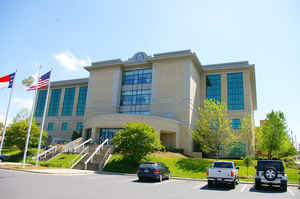
Randolph County is a county located in the state of North Carolina. Based on the 2010 census, the population was 141,752. Its county seat
is Asheboro.
Randolph County is included in the Greensboro-High Point, NC Metropolitan Statistical Area, which is also included in the
Greensboro-Winston-Salem-High Point, NC Combined Statistical Area.
Etymology - Origin of Randolph County Name
It was named in honor of Peyton Randolph of Virginia, who was president of the Continental Congress.
Demographics:
County QuickFacts: CensusBureau Quick Facts
Randolph County History
Randolph was formed in 1779 from Guilford. It was named in honor of Peyton Randolph of Virginia, who was president of the Continental Congress. It is in the central section of the State and is bounded by Chatham, Moore, Montgomery, Davidson, Guilford and Alamance counties. Its present land area is 787.36 square miles and its population in 2000 was 130,471. The act establishing the county authorized the first court and all subsequent courts to be held at the home of Abraham Reese unless otherwise decided upon by the justices of the peace until a courthouse could be built. Commissioners were named in 1783 to select a site for the county seat. This act directed that court be held at the home of William Bell until the courthouse was completed. In 1785 an act was passed removing the court from the house of William Bell and allowing the justices at each court to decide where the next court would meet until the courthouse was completed. In 1788 a town was established at the courthouse on the land of Thomas Dauggan. This town, was named Johnstonville in honor of Samuel Johnston. In 1791 an act was passed authorizing the construction of a prison at the courthouse. In 1792 an act was passed authorizing commissioners to select a site in the center of the county and have a new courthouse erected, as the old courthouse was not in the center of the county. In 1796 Asheborough was established as the county seat on the land of Jesse Henley. In 1819 a new courthouse was authorized to be built in Asheborough. Asheboro is the county seat.
Geography: Land and Water
As reported by the Census Bureau, the county has a total area of 789 square miles (2,040 km2), of which 783 square miles (2,030 km2) is
land and 6.8 square miles (18 km2) (0.9%) is covered by water.
Randolph County is located in the center of North Carolina, and the city of Asheboro (in the county) is the center point of North Carolina.
Randolph County is located in the Piedmont section of central North Carolina, a region of gently rolling hills and woodlands. However, the
central and western parts of the county contain the Uwharrie Mountains and the Caraway Mountains. These two ranges are the remnants of a
much-higher range of ancient peaks. Today, they rarely top 1,000 feet (300 m) above sea level, yet due to the relative low terrain around
them, they still rise 200 - 500 feet (61 - 152 m) above their base. The highest point in Randolph County is Shepherd Mountain, a peak in the
Caraways. The North Carolina Zoo is located atop Purgatory Mountain, one of the peaks of the Uwharries.
Neighboring Counties
Bordering counties are as follows:
- Guilford County - north
- Alamance County - northeast
- Chatham County - east
- Moore County - southeast
- Montgomery County - southwest
- Davidson County - west
Education
Randolph County School System serves most of the county. Asheboro City Schools serves Asheboro.


Click Image to Enlarge
