

Click Image to Enlarge
Pennsylvania Counties
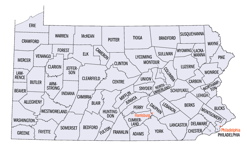
There are sixty-seven counties of the Commonwealth of Pennsylvania in the United States of America. The city of Philadelphia is coterminous with Philadelphia County, and governmental functions have been consolidated since 1854.Jefferson County, Pennsylvania
Jefferson County Education, Geography, and History
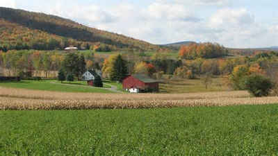
Jefferson County is a county located in the state of Pennsylvania. Based on the 2010 census, the population was 45,200. Its county seat is Brookville. The county was established on March 26, 1804, from part of Lycoming County and later organized in 1830. It is named for President Thomas Jefferson
Etymology - Origin of Jefferson County Name
Named for President Thomas Jefferson.
Demographics:
County QuickFacts: CensusBureau Quick Facts
Jefferson County History
Created on March 26, 1804 from part
of Lycoming County and named for President Thomas Jefferson. It was attached to
Westmoreland County until 1806 and then to Indiana County until 1830, when it
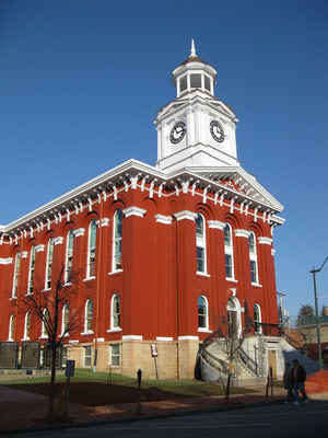
was formally organized. Brookvillle, the county seat, was laid out in 1830 and
incorporated as a borough on April 9, 1834. It is said to have been named for
the numerous brooks and in the vicinity.
Punxsutawney was a Delaware Indian village on the Great Shamokin Path.
Pennsylvania acquired the region at the Treaty of Fort Stanwix, or "Last
Purchase," in 1784. Lumber, marketed via conveniently southward flowing streams,
was the first industry and also led to boat building. Large-scale coal mining
began after the Civil War, assisted by a Pennsylvania Railroad trunk line
(opened in 1873), English capital investors, the Pennsylvania Geological Survey,
and good advertising. Mining fell off in the mid-1920s due both to labor
discontent and the falling coal market, but Jefferson is still the state's ninth
most productive bituminous county. Natural gas made possible a glass
manufacturing industry beginning in 1897. Although farms cover one-fifth of the
county, agricultural cash receipts are not high. Manufacture of building
structural elements and mining-related items is important in today's economy.
The value added from manufactures increased 56 percent between 1987 and 1992.
Punxsutawney's Groundhog Day is one of the nation's favorite myths, and the Cook
Forest State Park (shared with Clarion County) is the only significant preserved
stand of primeval hemlock and white pine trees in the state.
Geography: Land and Water
As reported by the Census Bureau, the county has a total area of 657 square miles (1,701 km2), of which, 655
square miles (1,698 km2) of it is land and 1 square miles (4 km2) of it (0.21%) is water.
Neighboring Counties
Bordering counties are as follows:
- Forest County (north)
- Elk County (northeast)
- Clearfield County (east)
- Indiana County (south)
- Armstrong County (southwest)
- Clarion County (west)
Education
Colleges and universities
Indiana University of Pennsylvania
Clarion University of Pennsylvania
Butler County Community College (Brockway)
Public school districts
Brockway Area School District
Brookville Area School District
Clarion-Limestone Area School District
DuBois Area School District
Punxsutawney Area School District


Click Image to Enlarge
