


Click Image to Enlarge
Utah Counties
There are twenty-nine counties in the State of Utah. There were originally seven counties established under the provisional State of Deseret in 1849: Davis, Iron, Sanpete, Salt Lake, Tooele, Utah, and Weber. The Territory of Utah was created in 1851 with the first territorial legislature meeting from 1851-1852. The first legislature re-created the original counties from the State of Deseret under territorial law as well as establishing three additional counties: Juab, Millard, and Washington. All other counties were established between 1854 and 1894 by the Utah Territorial Legislature under territorial law except for the last two counties formed, Daggett and Duchesne.Grand County, Utah
Grand County Education, Geography, and History
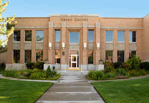
Grand County is a county located in the state of Utah. Based on the 2010 census, the population was 9,225. Its county seat and largest city is Moab. The county was named for the Colorado River, which at the time of statehood was known as the Grand River. It is west from the Colorado state line.
Etymology - Origin of Grand County Name
The Colorado River, which flows through the county, was first called the Grand River
Demographics:
County QuickFacts: CensusBureau Quick Facts
Grand County History
Grand County is situated on the Colorado Plateau eastern Utah. The plateau includes two-thirds of the state of Utah and parts of Colorado, New Mexico, and Arizona. Composed mostly of sandstone and limestone, the plateau has been eroded by large rivers and other water sources into huge canyons and complex erosional forms that make it a rugged but scenically spectacular region.Much of the Colorado Plateau in prehistoric times was inhabited by the Anasazi. First arriving perhaps as early as the time of Christ, the Anasazi had disappeared by A.D. 1300, probably due to years of drought. Today the remains of their cliff houses and rock art in the canyons delight explorers. A petroglyph of a mammoth or mastodon on a canyon wall west of Moab suggests occupation by Early Man.
The first white men to enter the present area of Grand County were Spanish explorers who discovered a crossing of the Colorado River at the site of the present highway bridge at Moab. Later Spanish traders and American fur trappers developed the route known as the Spanish Trail, using that crossing and one across the Green River above the present Emery County town of that name.
The first attempt by Mormon colonists to settle the Moab area was a failure. The Elk Mountain Mission reached Moab Valley in 1855 and established a small community, but the Indians who were already farming the fertile Colorado River bottoms regarded them as competition and drove them out after they had been there only a few weeks. Not until the very late 1870s and 1880s did a few Mormon families find it possible to build permanent homes.
Most of the history of Grand County has been the story of small family farms and orchards, mining for potash and uranium, and livestock. Large sheep and cattle companies have found abundant forage for their livestock in the canyons and the LaSal Mountains, and cowboys and outlaws figure prominently in the area's folklore. The uranium boom of the 1950s brought the first real population expansion to the area and saw the creation of a few large fortunes as well as many failures.
Most recently the income from tourism has been the county's major economic resource. Arches National Monument was established in 1929, and consistently increasing numbers of visitors led to its upgrading to National Park status in 1971. During the 1970s and 1980s Moab became perhaps the most important center for river running, mountain-bicycling, and four-wheel drive recreation in Utah.
*Souirce: Beehive History 14: Utah Counties. 1988. Utah State Historical Society, 300 Rio Grande, Salt Lake City, UT 84101-1182.
Geography: Land and Water
As reported by the Census Bureau, the county has a total area of 3,694 square miles (9,568 km2), of which, 3,682 square miles (9,535 km2) of it is land and 13 square miles (32 km2) of it (0.34%) is water. The Green River forms the western boundary and Colorado lies on the eastern boundary. The Colorado River flows through the southeast corner. Deserts, cliffs and plateaus make up the scenery, with few settlements apart from the city of Moab, a Colorado River oasis. Arches National Park lies in the southern part of the county, just north of Moab. Also, the northernmost extension of Canyonlands National Park lies in the southwest corner of the county.
Neighboring Counties
Bordering counties are as follows:
- Adjacent counties
- Uintah County, Utah - (north)
- Garfield County, Colorado - (northeast)
- Mesa County, Colorado - (east)
- San Juan County, Utah - (south)
- Emery County, Utah - (west)
- Carbon County, Utah - (northwest)
Education


Click Image to Enlarge
