


Click Image to Enlarge
Utah Counties
There are twenty-nine counties in the State of Utah. There were originally seven counties established under the provisional State of Deseret in 1849: Davis, Iron, Sanpete, Salt Lake, Tooele, Utah, and Weber. The Territory of Utah was created in 1851 with the first territorial legislature meeting from 1851-1852. The first legislature re-created the original counties from the State of Deseret under territorial law as well as establishing three additional counties: Juab, Millard, and Washington. All other counties were established between 1854 and 1894 by the Utah Territorial Legislature under territorial law except for the last two counties formed, Daggett and Duchesne.Juab County, Utah
Juab County Education, Geography, and History
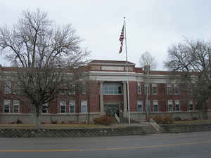
Juab County is a county located in the state of Utah. Based on the 2010 census, the population was 10,246. Its county seat and largest city
is Nephi. The county was named from a Native American word meaning thirsty valley, or possibly only valley.
Juab County is part of the Provo–Orem, UT Metropolitan Statistical Area, which is also included in the Salt Lake City-Provo-Orem, UT Combined
Statistical Area.
Etymology - Origin of Juab County Name
the Ute word meaning flat or level plain
Demographics:
County QuickFacts: CensusBureau Quick Facts
Juab County History
Juab County is a part of the Basin
and Range physiographic province. Most of the fertile farming land is located in
the Juab Valley near Nephi at the base of Mount Nebo (11,877 feet). The western
portion of the county consists of broad, semiarid valleys and low desert
mountains. The Wasatch Mountains are located to the east, and moving west there
are the East Tintic Range, West Tintic Range, Thomas Range (Topaz Mountain,
7,113 feet), Fish Springs Range, and the southern tip of the Deep Creek Range in
the extreme northwest corner of the county.
Archaic Period and Fremont Culture sites have been found in Juab County. Nephi
Mounds north of Nephi is one of the most important Fremont agricultural sites in
the eastern Great Basin. A portion of the Goshute Indian Reservation is located
in the northwest corner of the county.
In 1776 the Dominguez-Escalante expedition crossed the county at the eastern
end, from north to south, passing near present Nephi. Jedediah S. Smith
traversed the western end of the county in 1826 and via Fish Springs in 1827. In
1843-44 John C. Fremont journeyed through the county's eastern end on his way
north. Government explorers John W. Gunnison and J. H. Simpson traveled in the
area in 1853 and 1859 respectively. Gunnison visited the southeast portion of
the county while Simpson located the route later used by the Pony Express and
transcontinental telegraph.
During 1860-63 Goshutes attacked an overland mail station at Willow Creek. As a
result, the US Army set up a camp at Cedar Summit and a cantonment at Fish
Springs in 1863.
In 1852 the legislative assembly created Juab County, which extended as a narrow
strip to what was then the western boundary of Utah Territory (now the western
boundary of Nevada). The western portion was reduced in 1854 and 1856 to form
counties in Nevada, and several other changes in Juab's borders have been made
over the years.
The first settlement in Juab Valley occurred in 1851 when a group of Mormon
settlers arrived near Salt Creek at present day Nephi. Their economy was based
primarily on agriculture, In 1869 precious metals were discovered in the Tintic
region, changing the economic and industrial destiny of Juab County. The towns
of Diamond, Silver City, Mammoth, and especially Eureka became the main areas of
the Tintic Mining District, which by 1899 was labeled one of the foremost mining
districts in the country. From 1870 to 1899 Tintic produced approximately
$35,000,000 in mineral wealth. The metals in Tintic consisted of silver, gold,
copper, lead, zinc, and some uranium at Topaz Mountain. Mining continued through
the 1950s, and even today some mining operations continue on a small scale. In
recent years several small manufacturing firms have helped to diversify Juab's
economy.
Recreation at the White Sand Dunes, Little Sahara Recreation Area, remains very
popular, attracting tourists and visitors to western Juab.
*Source: Beehive History
14: Utah Counties. 1988. Utah State Historical Society, 300 Rio Grande, Salt
Lake City, UT 84101-1182.
Geography: Land and Water
As reported by the Census Bureau, the county has a total area of 3,406 square miles (8,822 km2), of which,
3,392 square miles (8,785 km2) of it is land and 15 square miles (38 km2) of it (0.43%) is water.
Neighboring Counties
Bordering counties are as follows:
- Tooele County, Utah - (north 1)
- Utah County, Utah - (north 2)
- Millard County, Utah - (south)
- Sanpete County, Utah - (east)
- White Pine County, Nevada - (west)
Education


Click Image to Enlarge
