


Click Image to Enlarge
Utah Counties
There are twenty-nine counties in the State of Utah. There were originally seven counties established under the provisional State of Deseret in 1849: Davis, Iron, Sanpete, Salt Lake, Tooele, Utah, and Weber. The Territory of Utah was created in 1851 with the first territorial legislature meeting from 1851-1852. The first legislature re-created the original counties from the State of Deseret under territorial law as well as establishing three additional counties: Juab, Millard, and Washington. All other counties were established between 1854 and 1894 by the Utah Territorial Legislature under territorial law except for the last two counties formed, Daggett and Duchesne.Sevier County, Utah
Sevier County Education, Geography, and History
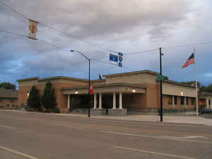
Sevier County is a county located in the state of Utah. Based on the 2010 census, the population was 20,802. Its county seat and largest city is Richfield. The county was formed on January 16, 1865, as a split off from Sanpete County to the north. It was named for the nearby Sevier River.
Etymology - Origin of Sevier County Name
It was named for the nearby Sevier River, from the Spanish Rio Severo
Demographics:
County QuickFacts: CensusBureau Quick Facts
Sevier County History
Sevier County is located in the High Plateau country of central Utah. Most of the towns lie near the Sevier River in a fertile valley bordered on the west by the Pahvant Range and on the east by the Wasatch and Fish Lake plateaus. National forests cover almost half of the land. The area is seismically active, and a number of earthquakes have centered in the southern part of the county on the Sevier Fault.Many prehistoric Indian sites have been found. Sudden Shelter, an Archaic site on Ivie Creek, contains one of the longest cultural time records in Utah east of the Wasatch 7080 to 80 B.P. (before the present). Fremont Culture sites continue to be found, especially during construction projects. Fremont State Park preserves artifacts from a recently uncovered prehistoric village. Travelers on the Old Spanish Trail and mountain man Jedediah S. Smith were among those who crossed the county before white settlement. The Southern Exploring Company under Mormon Apostle Parley P. Pratt visited the area during the winter of 1849-50, and George W. Bean explored the Sevier Valley in 1863. Early in 1864 ten men settled in the Richfield area. Several other towns were founded in the next few years. However, violent confrontations with the Ute Indians during the Black Hawk War (1865-68) forced abandonment of all the Sevier settlements in April 1867. Attempts to resettle did not succeed until 1870. The area grew rapidly. Richfield, with 8 families and 12 men in 1871, had 753 people by 1874 and was on its way to becoming a major regional commercial center and, eventually, the provider of hospital, airport, and other services for a large area. Many of the county's early settlers were Scandinavians who brought distinctive building styles and cultural practices with them. The Deseret Telegraph extended its line from Gunnison to Monroe in 1872, providing a vital communications link to the territory's larger cities. The Denver & Rio Grande Railroad reached Salina in 1891 and Richfield in 1896, improving the marketing of Sevier agricultural products. The building of Interstate 70 in the 1980s linked the county to the national freeway system. Sheep and cattle remain important to the local economy as do dairy products, field crops, and, in recent years, turkey raising. Trade and manufacturing - including food processing clothing and building products - have contributed to the county's growth as well. Sevier is the state's leading producer of gypsum, a mineral used in building products such as plaster and plasterboard produced in Sigurd. The county has coal mines and natural gas reserves in the northeast and major geothermal resources that could be tapped for energy production.
*Sources Beehive History 14: Utah Counties. 1988. Utah State Historical Society, 300 Rio Grande, Salt Lake City, UT 84101-1182.
Geography: Land and Water
As reported by the Census Bureau, the county has a total area of 1,918 square miles (4,968 km2), of which,
1,910 square miles (4,948 km2) of it is land and 8 square miles (21 km2) of it (0.42%) is water.
Neighboring Counties
Bordering counties are as follows:
- Sanpete County, Utah - (north)
- Emery County, Utah - (east)
- Piute County, Utah - (south 1)
- Wayne County, Utah - (south 2)
- Millard County, Utah - (west 1)
- Beaver County, Utah - (west 2)
Education


Click Image to Enlarge
