


Click Image to Enlarge
Wisconsin Counties
There are seventy-two counties in the state of Wisconsin. Wisconsin became part of the Territory of Michigan and divided into two counties: Brown County in the northeast along Lake Michigan and Crawford County in the southwest along the Mississippi River. The state of Wisconsin was created from Wisconsin Territory on May 29, 1848, with 28 counties.Brown County, Wisconsin
Brown County Education, Geography, and History
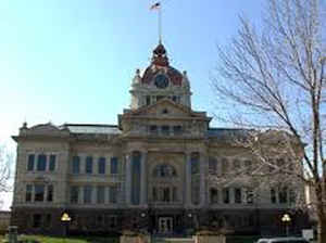
Brown County is a county in the state of Wisconsin. Based on the 2010 census, the population was 248,007, making it the fourth-most
populous county in Wisconsin. The county seat is Green Bay. Brown County is one of Wisconsin's two original counties along with Crawford
County and originally spanned the entire eastern half of the state when formed by the Michigan Territorial legislature in 1818. It was
named for Major General Jacob Brown, a successful military leader during the War of 1812.
Brown County is included in the Green Bay, WI Metropolitan Statistical Area.
Etymology - Origin of Brown County Name
Brown County was named for Major-General Jacob Brown of the United States Army (Gannett, Place Names, p. 33; Wis. Hist. Colls., i, p. 112). General Brown (1775-1828), born in Pennsylvania, was a successful leader in the War of 1812-15. At its close he retained the command of the Northern division, and in 1821 was made general-in-chief of the army. He died at Washington, D.C.
Demographics:
County QuickFacts: CensusBureau Quick Facts
BrownCounty History
John W. Hunt's 1853 Wisconsin Gazetteer:
"BROWN, County, is bounded on the north by Oconto, on the east by Kewaunee, on the south by Manitowoc, and on the west by Outagamie, and a portion of Oconto. It derived its name from General Brown, commander-in-chief of the army, and was originally organized by an act of the legislative council of the Territory of Michigan, approved 16th October, 1818, and then included all of the territory of the present state of Wisconsin, east of a line drawn due north from the northern boundary of Illinois, through the middle of the Portage be tween the Fox and Wisconsin rivers. Its limits have been decreased from time to time, until at present it contains only fourteen and a half townships, being 21 by 24 miles square, with an addition of 3 by 6 miles to its northwestern corner. Its streams are: Fox, (Neenah), Manitoo, (or East), Ashwabena and Big Suamico rivers, and Duck creek. The soil is better adapted to grazing than the raising of grain, although it produces good crops of wheat, rye, oats, potatoes, &c. The surface is mostly level or slightly undulating, with but little swamp or waste land. It is mostly heavily timbered, with maple, beech, birch, &c., interspersed with pine and a good proportion of hemlock. The population in 1825 was 952; 1830, 964; 1836, 2,706; 1838, 3,081; 1840, 2,107; 1842, 2,146; 1846, 2,632; 1847, 2,914; 1850, 6,222. Farms, 267; manufactories, 23; and dwellings, 1,005. It must be borne in mind that new counties were established from the county of Brown, between nearly every taking of the census, and that the foregoing table, so far as showing the increase of population is concerned, is a very unsatisfactory one."
BROWN.
From: Handbook of Wisconsin by S. Silas, 1855
pg. 49-50
One of the three original counties of Wisconsin, embracing all the State North of Milwaukee and East of the Wisconsin River, but now one of the smallest counties in the State. A part of the Oneida reservation is in this County. The lower Fox River flows through this county, the largest stream of water in the State, and containing the best water power. This River has been made navigable the whole of its distance by the Fox River Improvement Co., and steamboats will run during the Summer of 1856 from Lake Winnebago to Green Bay. There is some good land still unoccupied in the Eastern and Southeastern part of the County. It is well watered, undulating but not hilly, and has but
little swamp or other waste land. The timber is maple, beech, and birch, interspersed with pine, and some hemlock. Duck Creek, and Big Suamico flow through the County.
Green Bay, at the month of the Fox, is one of the oldest settlements in the State, and is the centre of a heavy lumber trade, which has met with a stimulus in the high price which lumber has commanded during the past year, owing to the opening of new avenues for supplying Illinois and Wisconsin. It is supposed that more than twice the timber will be cut during the Winter of 1855 and '6 than at any season heretofore. Green Bay will also be the port of shipment of a large back country. Steamers run from this port to Buffalo.
The Green Bay, Lake Shore and Chicago Rail Road has its northern terminus at this place.
Geography: Land and Water
As reported by the Census Bureau, the county has a total area of 615 square miles (1,594 km2), of which, 529
square miles (1,369 km2) of it is land and 87 square miles (225 km2) of it (14.10%) is water.
Neighboring Counties
Bordering counties are as follows:
- Oconto County - north
- Kewaunee County - east
- Manitowoc County - southeast
- Calumet County - southwest
- Outagamie County - west
- Shawano County - northwest
Education


Click Image to Enlarge
