


Click Image to Enlarge
California Counties
The state of California is divided into fifty-eight counties. On January 4, 1850, the California constitutional committee recommended the formation of 18 counties. They were Benicia, Butte, Fremont, Los Angeles, Mariposa, Monterey, Mount Diablo, Oro, Redding, Sacramento, San Diego, San Francisco, San Joaquin, San Jose, San Luis Obispo, Santa Barbara, Sonoma, and Sutter. The last California county to have been established is Imperial County in 1907.Alpine County, California
Alpine County Education, Geography, and History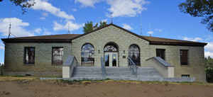
Alpine County, officially the County of Alpine, is a county located in the state of California. Based on the 2010 census, the population was 1,175. making it the least populous county in California. The county seat is the Census Designated Place of Markleeville. Alpine County was created in 1864 from parts of adjacent counties. This county was named for the English word alpine meaning "of, pertaining to, or connected with, the Alps."
Alpine County is located in the Sierra Nevada, between Lake Tahoe and Yosemite National Park.
Etymology - Origin of Alpine County Name
Alpine county derived its name from the English word alpine meaning "of, pertaining to, or connected with, the Alps." Lying as it does on the crest of the Sierra Nevada mountains, its geographical position makes it particularly an alpine county, and hence its name.
Demographics:
County QuickFacts: CensusBureau Quick Facts
Alpine County History
Alpine County was created in 1864 during a
silver boom in the wake of the nearby Comstock Lode discovery. The
county was formed from parts of Amador, El Dorado, Calaveras and
Tuolumne Counties. During the founding of the county it had a
population of about 11,000. By 1868 however, the local silver mines had proven
unproductive, and the population fell to
about 1,200.
The native Washo people were the first to call Alpine County home, who occupied the mountains and valleys of western
Nevada and eastern California. Living in harmony with the land. The Washo excelled in basketry and spent their summers
around the shores of Lake Tahoe. The southern band of the tribe , the Hung Lel Ti, lived around the Diamond Valley
area of Alpine County. The earliest explorers through the region included Jedediah Smith and Joseph Walker, but it was
John Fremont and Kit Carson, in their famous midwinter trip across Alpine County and the Sierra Nevada in 1844 that
brought attention to possible travel routes across the range.
In 1848 members of the Mormon Battalion and a year later by the Gold Rush '49ers,
followed the Carson Route of the
California Emigrant Road, now Highway 88. It was the most heavily used road to California in those early years.
It took silver, not gold, to bring settlement to Alpine County. Following the discovery of the Comstock Lode
near Virginia City in 1859, thousands of prospectors flocked into the eastern Sierra Nevada looking for riches. A year
earlier, a group of Scandinavian men had discovered rich silver outcrops near Silver Creek and established the town of
Silver Mountain.
During the next several years, the population grew, and while there was plenty of mining activity, there was a scarcity of
paying ore. Nearby, the towns of Monitor and Mt. Bullion grew from the hills, fostered by the belief in another
'Comstock' just around the corner.
In 1861, one Jacob Marklee took up a 160 acre claim and built a bridge and toll station on the banks of a stream
crossing the road from Genoa, Nevada ten miles north of Silver Mountain City. Killed in a gunfight in 1863, Marklee
would give his name to the future County seat, Markleeville, and creek of the same name.
As the Silver Mountain ore proved too stubborn to recover at a profit,
men began to leave the area, and by 1868, Alpine County had fewer than
1200 people. Miners also left the rich gold fields of Bodie
only 80 miles away. Silver Mountain was the first County Seat of Alpine County. The excitement was short-lived. The finishing blow came with the demonitization of silver in 1873, collapsing prices and
closed the remaining mines.
Markleeville stood ready to succeed its neighbor as County seat, which was accomplished in 1875.
In spite of its own loss of
population, the town had begun to develop into a trade center for the ranching and lumber business, which were still
supplying the booming Comstock Lode mines. In 1885, Markleeville suffered a terrible fire, but the town was quickly
rebuilt. Several buildings, including the Fisk Hotel (formerly the Alpine Hotel) now the Wolfcreek Restaurant and the
log jail were moved from Silver Mountain, though with a reduced population, many lots remained vacant.
There are no incorporated cities in the county.
Geography: Land and Water
As reported by the Census Bureau, the county has a total area of 743 square miles (1,925 km2), of which, 739 square miles (1,913 km2) of it is land and 5 square miles (12 km2) of it (0.61%) is water.
Its geographical position, lying as it does on the crest of the
Sierra Nevada mountains, makes it particularly an alpine county.
Neighboring Counties
Bordering counties are as follows:
- Northeast: Douglas County, Nev.
- Southeast: Mono County
- South: Tuolumne County
- Southwest: Calaveras County
- West: Amador County
- Northwest: El Dorado County
Education


Click Image to Enlarge
