


Click Image to Enlarge
California Counties
The state of California is divided into fifty-eight counties. On January 4, 1850, the California constitutional committee recommended the formation of 18 counties. They were Benicia, Butte, Fremont, Los Angeles, Mariposa, Monterey, Mount Diablo, Oro, Redding, Sacramento, San Diego, San Francisco, San Joaquin, San Jose, San Luis Obispo, Santa Barbara, Sonoma, and Sutter. The last California county to have been established is Imperial County in 1907.Napa County, California
Napa County Education, Geography, and History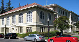
Napa County is a county located north of San Pablo Bay in the northern portion of the state of California. Based on the 2010 census, the
population was 136,484. The county
seat is the City of Napa. Napa county was
created February 18, 1850. The county is named
after Napa Valley.
Napa County comprises the Napa, CA Metropolitan Statistical Area, which is also included in the San Jose-San Francisco-Oakland, CA Combined
Statistical Area. It is one of four North Bay counties.
Etymology - Origin of Napa County Name
Named after Napa Valley. The word napa is of Indian derivation and has been variously translated as "grizzly bear," "house," "motherland" or "fish." Of the many explanations of the names's origin, the most plausible seems to be that it is derived from the Patwin word napo meaning house.
Demographics:
County QuickFacts: CensusBureau Quick Facts
Napa County History
Napa County was created 1850. It was named after Napa Valley. The word 'napa' is of Indian derivation
and has been variously translated as "grizzly bear," "house," "motherland" or "fish." Of the many
explanations of the names's origin, the most plausible seems to be that it is derived from the Patwin
word napo meaning house. Napa County was one of the original counties of California, created in 1850 at
the time of statehood. Parts of the county's territory were given to Lake County in 1861.
On January 4, 1850, a committee of California's first constitutional convention, chaired by General
Mariano Vallejo, recommended the creation of eighteen counties. They were Benicia, Butte, Fremont, Los
Angeles, Mariposa, Monterey, Mt. Diablo, Oro, Redding, Sacramento, San Diego, San Francisco, San
Joaquin, San Jose, San Luis Obispo, Santa Barbara, Sonoma, and Sutter.
Between January 4 and February 18, 1850, the California legislature added nine counties to the list
recommended by General Vallejo's committee, some of the changes based on additional recommendations by
the committee. The nine added counties were Branciforte, Calaveras, Coloma, Colusi, Marin, Mendocino,
Napa, Trinity, and Yuba. This brought the total number of counties to 27. The legislature also approved
several name changes. Benicia was renamed El Dorado, Fremont was renamed Yola, Mt. Diablo was renamed
Contra Costa, San Jose was renamed Santa Clara, Oro was renamed Tuolumne, and Redding was renamed
Shasta.
Effective February 18, 1850, twenty-seven counties were created in California. The new counties were
Branciforte, Butte, Calaveras, Colusi, Contra Costa, El Dorado, Los Angeles, Marin, Mariposa, Mendocino,
Monterey, Napa, Sacramento, San Diego, San Francisco, San Joaquin, San Luis Obispo, Santa Barbara, Santa
Clara, Solano, Sonoma, Sutter, Trinity, Tuolumne, Yola, and Yuba. In early 1850, not long after the
legislature adopted its first statute creating counties, new statutes were adopted changing some county
names. Branciforte was changed to Santa Cruz, Colusi was changed to Colusa, and Yola was changed to
Yolo.
The Napa valley became one of the first in California to be settled by American farmers,
around 1830.
When California was granted statehood in 1850, Napa Valley was in the territory of California, district
of Sonoma. When counties were first being organized, in 1850, Napa
county became one of the original 27
counties of California with "Napa City" (later shortened to Napa) as the county seat.
In 1848, Napa City was laid out by Nathan Coombs on property he
attained from Nicholas Higuera's Rancho
Entre-Napa, an 1836 Mexican Land Grant. By 1870, smallpox and
other new diseases had all but wiped out the native inhabitants of Napa
Valley.
The gold rush of the early 1850s that caused Napa City to grow. After the first severe winter in
the gold fields, miners sought warmer protection in the young city. There was plenty of work on the cattle
ranches and in the lumber industry. Sawmills in the Valley were cutting timber that was hauled by horse
team to Napa City where it was then shipped out through the Napa River to Benicia and San Francisco.
Napa Valley is known mostly for its premier wines. White settlers planted
vineyards with cuttings supplied by Catholic priests from Sonoma and San Rafael. In 1861, Riesling
cuttings were presented to the Valley and, from these small beginnings, Napa Valley has become
renowned as
one of the premier wine-making regions of the world.
Geography: Land and Water
As reported by the Census Bureau, the county has a total area of 788 square miles (2,042 km2), of which, 754 square miles (1,952 km2) of it is land and 35 square miles (89 km2) of it (4.38%) is water.
The two mountain ranges of the Napa Valley were formed during the
creation of the San Andreas fault. The Vaca Range forms the valley's
eastern boundary and it protects Napa county from the scorching heat of
the Central Valley. The Mayacamas Mountains separate Napa county on the
west from the cooler, marine effects felt in neighboring Sonoma County.
The hills and knolls you see on the valley floor influence weather
patterns within those areas. Due to the countys' distinctive geographic
position between the cold Pacific Ocean and the often hot Central
Valley, a wide variety of climatic conditions exist within this small,
adjoining area that are flawlessly matched to producing a huge variety
of world-class wine grapes.
Neighboring Counties
Bordering counties are as follows:
- Northeast: Yolo County
- Southeast: Solano County
- West: Sonoma County
- Northwest: Lake County
Education
In addition to its many public and private schools, two colleges also operate in the County. Pacific Union College, classified as a National Liberal Arts College by the Carnegie Foundation, is the county's only four-year college and serves roughly 1500 students. Napa Valley College, a community college, offers two-year degrees in the county


Click Image to Enlarge
