


Click Image to Enlarge
California Counties
The state of California is divided into fifty-eight counties. On January 4, 1850, the California constitutional committee recommended the formation of 18 counties. They were Benicia, Butte, Fremont, Los Angeles, Mariposa, Monterey, Mount Diablo, Oro, Redding, Sacramento, San Diego, San Francisco, San Joaquin, San Jose, San Luis Obispo, Santa Barbara, Sonoma, and Sutter. The last California county to have been established is Imperial County in 1907.Sierra County, California
Sierra County Education, Geography, and History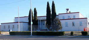
Sierra County is a county located in the state of California. Based on the 2010 census, the population was 3,240 making it the second-least populous county in California. The county seat is Downieville. The county was created April 16, 1852. Sierra Nevada is named from the Spanish words that mean "snow saw,"applied to the Sierra Nevada mountain chain because of the jagged peaks forming the skyline.
Etymology - Origin of Sierra County Name
Sierra Nevada in Spanish means "snow saw," applied to the Sierra Nevada mountain chain because of the jagged, serrated, peaks forming the skyline.
Demographics:
County QuickFacts: CensusBureau Quick Facts
Sierra County History
Sierra County was formed from parts of Yuba County in 1852. The county derives its name from the Sierra Nevada. The
Washoe and Maidu Indians lived peacefully in the area before gold was discovered 100 years ago in November,1849 on the
North Fork Yuba River.
The development of Sierra County was a direct result of the discovery and continuous search for gold in California. As the roads improved, people began to travel to the more
simple environment to enjoy the beauty and
wildlife. In the 1800's a rush of interest arose from the city people for recreation and relaxation as a temporary
relief from the frantic pace of urban life.
Geography: Land and Water
As reported by the Census Bureau, the county has a total area of 962 square miles (2,491 km2), of which, 953 square miles (2,469 km2) of it is land and 9 square miles (22 km2) of it (0.89%) is water.
The county is located
in the Sierra Nevada, northeast of Sacramento on the border with Nevada.
Neighboring Counties
Bordering counties are as follows:
- North: Lassen County
- Northeast: Washoe County, Nev.
- Southwest: Nevada County; Yuba County
- Northwest: Plumas County
Education
Sierra-Plumas Joint Unified School District


Click Image to Enlarge
