


Click Image to Enlarge
California Counties
The state of California is divided into fifty-eight counties. On January 4, 1850, the California constitutional committee recommended the formation of 18 counties. They were Benicia, Butte, Fremont, Los Angeles, Mariposa, Monterey, Mount Diablo, Oro, Redding, Sacramento, San Diego, San Francisco, San Joaquin, San Jose, San Luis Obispo, Santa Barbara, Sonoma, and Sutter. The last California county to have been established is Imperial County in 1907.Sonoma County, California
Sonoma County Education, Geography, and History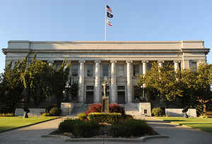
Sonoma County is a county in the state of California. Based on the 2010 census, its
population was 483,878. Its county
seat
and largest city is Santa Rosa. The county was created
February 18, 1850. Sonoma county is named from a
Chocuyen Indian name translated by some as "Valley of the Moon"and by
others as "land or tribe of the Chief Nose."
Sonoma County comprises the Santa Rosa, CA Metropolitan Statistical Area, which is also included in the San Jose-San Francisco-Oakland, CA
Combined Statistical Area. It is the northwestern county in the nine-county San Francisco Bay Area region.
Etymology - Origin of Sonoma County Name
Sonoma county is named from a Chocuyen Indian name translated by some as "Valley of the Moon" and by others as "land or tribe of the Chief Nose."
Demographics:
County QuickFacts: CensusBureau Quick Facts
Sonoma County History
Sonoma County, located on the northern coast of California, an original county, created February 18, 1850. County seat, Santa Rosa. Sonoma is a Chocuyen Indian name translated by some as "Valley of the Moon" and by others as "land or tribe of the Chief Nose."
In the early 1850s the town of Sonoma had waned in importance in terms of both commerce and population, its county buildings were crumbling, and it was quite remote. As a result, components in the newer, rapidly growing towns of Petaluma, Santa Rosa, and Healdsburg began competing to move the county seat to their towns. The dispute was between the bigger, richer commercial town of Petaluma and the more centrally located, growing agricultural center of Santa Rosa. The fate was decided following an election for the state legislature in which James Bennett of Santa Rosa defeated Joseph Hooker of Sonoma. He then introduced a bill that ultimately resulted in Santa Rosa being confirmed as county seat in 1854. Supposedly, several Santa Rosans, not wanting to wait, decided to take action. One night they rode down the Sonoma Valley to Sonoma, took the county seals and records, and brought them to Santa Rosa.
Geography: Land and Water
As reported by the Census Bureau, Sonoma County has a total area of 1,768 sq mi (4,580 km2). 1,576 sq mi (4,082 km2) is land, and 192 sq mi (498 km2) (10.88%) is water.
Sonoma County is a diverse landscape. The county is made up of
redwood forests and orchards. In Sonoma County, the Russian River, winds
through a valley of vineyards. On the west side of the county, the
Russian River continues its run through Green Valley, finally emptying
into the ocean at Jenner.
Neighboring Counties
Bordering counties are as follows:
- North: Lake County
- East: Napa County
- Southeast: Solano County
- South: Marin County
- West: North Pacific Ocean
- Northwest: Mendocino County
Education
Higher education
- Empire College, Santa Rosa
- Golden Gate University (Rohnert Park satellite of Walnut Creek Campus)
- Santa Rosa Junior College
- Sonoma State University, Rohnert Park
- University of Northern California, Santa Rosa
- University of San Francisco (Santa Rosa Campus)
The educational system of Sonoma County is similar to that of other counties in California.


Click Image to Enlarge
