


Click Image to Enlarge
California Counties
The state of California is divided into fifty-eight counties. On January 4, 1850, the California constitutional committee recommended the formation of 18 counties. They were Benicia, Butte, Fremont, Los Angeles, Mariposa, Monterey, Mount Diablo, Oro, Redding, Sacramento, San Diego, San Francisco, San Joaquin, San Jose, San Luis Obispo, Santa Barbara, Sonoma, and Sutter. The last California county to have been established is Imperial County in 1907.Stanislaus County, California
Stanislaus County Education, Geography, and History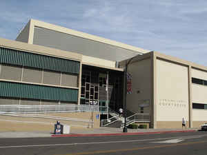
Stanislaus County is a county located in the Central Valley of the state of California. Based on the 2010 census, the population was 514,453. The county seat is Modesto. The county was created April 1, 1854. Stanislaus is named for a version of Estanislao, the baptismal name of a mission-educated renegade Indian chief who led a band of Indians in a series of battles against Mexican troops.
Stanislaus County comprises the Modesto Metropolitan Statistical Area.
Etymology - Origin of Stanislaus County Name
The word Stanislaus is a version of Estanislao, the baptismal name of a mission-educated renegade Indian chief who led a band of Indians in a series of battles against Mexican troops. He was finally defeated by General Mariano G. Vallejo in 1826. The county is named for the Stanislaus River, first discovered by Gabriel Moraga in 1806, and later renamed Rio Estanislao for the Indian chief.
Demographics:
County QuickFacts: CensusBureau Quick Facts
Stanislaus County History
Stanislaus County was formed from part of Tuolumne County in 1854.
Stanislaus County is a county located in the Central Valley of the state
of California, between Stockton and Fresno. The county seat is Modesto.
Timeline
Pre-European. In the area to be known as Stanislaus County, lived two native cultures: Miwoks and Yokuts. The Miwoks lived along the eastern side, primarily in the foothills, while the Yokuts lived in the valley.
October 1776. Spanish military officer Jose Joaquin Moraga traveled east from San Francisco and entered the San Joaquin Valley exploring for three days and wrote this description: "a great treeless, level plain, where no water was in evidence, while overhead the rays of the sun made themselves uncomfortably felt." It is not known if he entered the Stanislaus County area or not.
October 1806. Spanish Military officer Gabriel Moraga (son of Jose Joaquin Moraga) explored the inland area and is considered the first European to explore the area to later be known as Stanislaus County. He saw the Stanislaus River and named it Rio de Nuestra Senora Guadalupe. He returned in 1808 and 1810, exploring the inland area.
May 1829. Two battles took place between Mexican soldiers and native people, led by ex-San Jose Mission Indian, Estanislao, near the junction of the Stanislaus and San Joaquin rivers. Estanislao was given his name by the mission padres in honor of Polish saint, St. Stanislaw.
Winter 1826-1827. American trapper, Jedediah Smith, with 15-20 men, traveled through the area to be known as Stanislaus County.
1829-1830. American trapper, Ewing Young, along with 20-year old Kit Carson, traveled through the area to be known as Stanislaus County.
1833. American trapper, Joseph Walker, traveled through the area to be known as Stanislaus County, with an expedition of 60 men who were sent by US Captain Bonneville from the Great Salt Lake area.
1843. The first settlements, in an area later to be known as Stanislaus County, were in the form of Mexican land grants. In November 1843, Mexican Governor Micheltorena granted land to Valentin Higuera and Rafael Feliz, which became known as El Pescadero, with 34,446 acres, located west of the San Joaquin River, bordering San Joaquin County. In December 1843, the governor granted land to Francisco Rica and Jose Castro, which became known as Rancheria del Rio Estanislao, with 48,887 acres, located north of Stanislaus River, bordering Tuolumne County.
1844. Two additional land grants were sanctioned by the Mexican governor. In January 1844, the governor granted land to Mariano Hernandez, which became known as Rancho del Puerto, with 13,340 acres, located west of the San Joaquin River and south of Rancho Pescadero. In February 1844, the Mexican governor granted land to Sebastian Nunez, which became known as Rancho Orestimba, with 26,666, located west of the San Joaquin River and south of Rancho El Pescadero.
March 27-April 1, 1844. Captain John C. Fremont explored the region to be known as Stanislaus County, while on a mapping expedition for the US Government. He wrote, "We came suddenly upon the Stanislaus River and hoped to find a ford, but the river was flowing by dark, deep, and swift, swollen by the mountain snows."
1846. Mexican Governor Pio Pico granted land to John Rowland, with 48,887 acres, which sometimes was called the San Joaquin and Stanislaus Land Grant. It was the same land that had been granted to Rica and Castro in 1843. Rowland didn't occupy his land until the Mexican War ended and then his land claim was validated by US Land Commission.
John C. Fremont traveled through the region to be known as Stanislaus County on his second expedition.
Mormon Sam Brannan brought settlers to a spot 1 1/2 miles north of the junction of the Stanislaus and San Joaquin rivers River, near present day Salida. On the south bank had been Estanislao's camp, and on the north bank (in today's San Joaquin County), Brannan established the settlement of New Hope or Stanislaus City. But, settlers of New Hope lived on both sides of the river, which meant they lived in the future Stanislaus County. Mormon President Brigham Young could not agree with Brannan to settle the Mormon people at New Hope instead of in the Valley of the Great Salt Lake. Many of the Mormon settlers went to the gold mines or to Utah abandoning the settlement.
June 13, 1846. Mexican Governor Pio Pico granted land to Alfias Basil Thompson, which would become known as Thompson's Ranch with 35,533 acres and located west of Rancheria del Rio Estanislao. A legal problem arose since the Pico granted the land to Thompson a month after the United States declared war on Mexico, but prominent Americans in California testified that Thompson had accepted the land in good faith and hence retained title. The Land Commission fixed the date of July 7, 1846 as the end of Mexican authority in California, which meant Thompson's claim was legal having been granted the land nearly a month before Mexican authority had ceased.
1849. Grayson or Graysonville was founded by a company of seven men, which included John Westley Van Benscroten and Andrew Jackson Grayson. It was located on the west bank of the San Joaquin River near the mouth of the Stanislaus River. The town was named for Grayson because he was the oldest member of the company. Grayson was a native of Louisiana, active in the Mexican War of 1846 and an authority of Pacific Coast birds. Van Benscroten was a native of New York City and came to California with Captain Fremont in 1846.
Paxton McDowell and Major R.D. Hammond founded Tuolumne City, which was located five miles upstream on the north bank of the Tuolumne River.
Dr. Adams founded the town of Adamsville, on the south bank of the Tuolumne River, three miles above Tuolumne City.
Either Benson & Byers or a Mr. Townsend founded the town of Crescent City, near the site of present day Modesto.
The town of Knights Ferry was founded by trapper and hunter William Knight. Knight had been with Fremont's expedition and felt the site perfect for a ferry crossing. The first county bridge was located at Knights Ferry, which washed away during 1862 flood, but later rebuilt.
Early 1850s. There were many settlements and river ferries located along the three rivers in the Stanislaus County area. Hillgard and Burman Ferry was located west of Salida on the Stanislaus River. Murphy's Ferry was further upstream. Major Burney's Burneyville Ferry was at present day Riverbank where the current bridge stands. Further up the river at Lover's Leap stood Keeler's Ferry and further up was Knights Ferry. On the Tuolumne River, beginning near the junction with the San Joaquin River were the following ferries and settlements: Tuolumne City, Paradise City, Adamsville, Westport Landing, Whitmore Ferry (where Southern Pacific RR bridge is located, Empire City, Baker's Ferry (Waterford), Dickinson's Ferry (Robert's Ferry), and La Grange. On the San Joaquin River, beginning at the Merced County line were the ferries: Hill's Ferry, Blair's Ferry, Russell's Ferry, Ward's Ferry, and Turner's Ferry.
1850. John S. Marvin, a lawyer from Boston, founded the town of Empire City, on the south bank of the Tuolumne River, just above Crescent City.
Jesse Hill established Hill's Ferry, just north of the junction of the Merced and San Joaquin rivers, on the Orestimba Rancho.
May 1850. The side-wheel steamboat, Georgiana, was the first steamboat to enter what would be Stanislaus County. It traveled to Grayson and Tuolumne City.
September 9, 1850. California was admitted to the Union and was divided into 29 counties. The area soon to be known as Stanislaus County was part of Tuolumne County at that time.
January 16, 1851. The first marriage took place in what would be Stanislaus County. N.W. Wells married Fanny Grunell. Rev. James Woods from the First Presbyterian Church in Stockton performed the marriage ceremony.
1852. French Bar or La Grange was founded. Elam Dye located his rancho along the Tuolumne River, which would be the site of booming town of La Grange. About the same time, French miners struck gold on a bar in the river (French Bar), which drew a more miners, and by 1854 there were over hundred buildings in the new town of La Grange.
1854. The county's first public school opened at Newsom's Bridge near Orestimba Creek.
April 1, 1854. California Governor Bigler signed into law the establishment of Stanislaus County, which was formed from Tuolumne County, having a population of less than a thousand residents.
June 10, 1854. The first county election was held and Adamsville was selected as the county seat by thirty votes over Empire City. Adamsville was founded in 1849 by the county's first practicing physician, Dr. David Adams, and had a hotel, ferry and a few scattered residences. H.W. Wallis was elected County Judge; William D. Kirk as County Sheriff; Robert McGarvey as Clerk and Recorder; and S.P. Scaniker as District Attorney.
July 3, 1854. The first meeting of the County Court of Sessions (Board of Supervisors) was held under an oak tree with these members in attendance: County Judge H.W. Wallis, Major James Burney and Eli S. Marvin.
August 7, 1854. The first murder was recorded in the county, which occurred at Adamsville. It was a gun duel between ex-sheriff of Tuolumne County, George Worth, and Eli Lyons in which Worth was wounded fatally. The dispute arose over the June election in which H.W. Wallis was elected County Judge.
October 21, 1854. An election was held, which moved the county seat from Adamsville to Empire City, by a margin of 29 votes. Empire City was founded in 1850 and in 1854 had over 200 residents.
May 7, 1855. The first meeting of the County Board of Supervisors was held at Empire City replacing the old County Court of Sessions. Members of the board were: D.B. Gardner, John Newsom and Robert Smith, with R. McGarvey serving as clerk.
December 20, 1855. An election was held moving the county seat from Empire City to La Grange by a vote of 558 to 139. La Grange was a mining town, having more population and wealth.
1859. Settlers led by W.W. Baker established the community of Bakersville on the south bank of the Tuolumne River. Soon his family moved to the north bank. Bakersville's name was changed to Waterford eventually because the postal system said Bakersville was too common of a name.
September 1859. The first newspaper in the county appeared and was called the Knights Ferry Bee, published by W.J. Collier. It was printed every Saturday morning, was four pages in length, and sold for 25 cents a copy.
1861. The first county militia was formed at Knights Ferry and was known as the Knights Ferry Mounted Rifle Company.
Winter 1861-1862. The rivers swelled in a horrific flood that inundated many river settlements.
September 3, 1862. An election was held moving the county seat from La Grange to Knights Ferry. In 1860, legislation sponsored by State Assemblyman Minor Walden of Stanislaus County, became law annexing Knights Ferry into Stanislaus County. Apparently, the county was suffering financially and needed a boost from Knights Ferry, which was prosperous and center of trade to the southern mines. A year earlier on September 4, 1861, an election was held, but La Grange retained the county seat in that election by a vote of 422-393.
1867. John W. Mitchell, local rancher of wealth, founded Paradise City, which was located 4 miles above Tuolumne City on the Tuolumne River.
May 1868. Banner wheat crop. The wheat crop yielded 2,317,652 bushels with many ranches harvesting 50-70 bushels an acre. In the next two decades, the county would produce gargantuan crops, to be sent worldwide.
May 1869. The clearing of debris from the Stanislaus River, beginning at Burneyville (Riverbank) to the San Joaquin River was completed. This would allow for travel up the river with much less danger.
September 22-24, 1869. The first county fair was held at Covert's Hall in Tuolumne City, where needlework and other home crafts were displayed along with samples of wheat and barley. Horse racing was held at Miner Walden's track, two miles west of Tuolumne City, and Bartholomew's circus gave a performance.
1870. Salida was established as a railroad station when track construction of the Central Pacific Railroad reached that point. Salida in Spanish means departure. The original settlement in the area near the station was Murphy's Ferry.
March 1870. California fencing law now extended through Stanislaus County requiring cattlemen to fence in their stock to keep them from the large wheat acreages. There were over 18,500 cattle in the county in 1860.
November 8, 1870. The construction of the Central Pacific Railroad reached a station to be named after railroad director and financier William C. Ralston, but Ralston turned down the honor, and the station instead was named Modesto, which is Spanish for modest. Merchants moved their businesses and buildings from the towns of Paradise, Tuolumne, Empire and Westport to Modesto, and by February 1871, there were 75 buildings in the new railroad town.
1871. Construction of the Central Pacific Railroad reached a station to be named after local landowner John W. Mitchell, which he declined and suggested it be named after Turlough in the county of Mayo, Ireland. The new railroad town was named Turlock.
Valley Home and Oakdale were established as new stations for the Copperopolis and Visalia Railroad.
Construction had begun on the irrigation canal of the San Joaquin and King's River Canal and Irrigation Company to bring water to the west side of the Stanislaus County from Fresno County.
September 6, 1871. An election was held moving the county seat to Modesto. The results were: 893 votes for Modesto, 340 for Knights Ferry, 79 for Oakdale, 12 for Waterford, 3 for La Grange and 2 for Graysonville. The County Board of Supervisors officially designated Modesto as the county seat on October 15, 1871.
April 15, 1873. The first county grange was organized in the county and located in Modesto. J.D. Spencer was elected to be the first master.
July 14, 1873. The new county courthouse in Modesto was opened. It was a rectangular three-story brick and stucco building, costing $60,000.
1874. Ceres was established as a station of the Southern Pacific Railroad. Elma Carter, daughter of early settler Levi Carter, selected its name. Daniel Whitmore had informally called the area Ceres, Roman goddess of agriculture, because of the fine crops grown there.
April 2, 1875. William Dona was executed on the county courthouse grounds in Modesto for the saloon shooting of James Connolly. The scaffolding was borrowed from San Joaquin County and was surrounded by a high board fence to screen out the public, except for certain witnesses prescribed by law.
October 6, 1875. A jackrabbit drive was organized near Turlock in which 413 rabbits were killed. The rodent had become a real nuisance to farming because of its eating grain sprouts and seed.
1877. Lack of winter rain destroyed the county's grain crop. One writer described the condition, "In forty-two miles there is not a spear of green grass nor a blade of wheat to be seen. The isolated farmhouses presented an aspect of poverty. Many of them are deserted and the farmers and their families have gone to other places to find employment. Some of the farmers, more fortunate, have wells of water and their farms are quite thrifty around their dwellings."
August 14, 1879. A group of vigilantes raided Modesto saloons and other buildings of vice to clean up the town and institute order.
July 20, 1884. Fire destroyed 5,000 acres of grain near Oakdale.
1887. Westley and Newman were established along the newly laid tracks for the Southern Pacific Railroad. The town of Crows Landing was moved four miles west to be along the newly laid tracks. Newman was named for Simon Newman. The residents of Hill's Ferry and Dutch Corners moved to the new town. Westley was named in memory of John Westley Van Benschoten, a butcher who came with Fremont, served in the Mexican War of 1846 and settled in the area in 1850.
October 29, 1887. An infantry company of young men and known as the Modesto Cadets officially joined the state's National Guard.
March 1887. The Wright Act became law, which led to the formation of the Turlock Irrigation District and Modesto Irrigation District.
1891. The community of Claribel was established as well as Hickman, Montpelier and Waterford along railroad lines.
1893. La Grange Dam was completed to provide irrigation water to the county. The dam was 336 feet long and 127 feet high.
1896. The communities of Claus, Riverbank and Empire were established along the San Francisco & San Joaquin Valley Railroad tracks, which soon became the Atchison, Topeka and Santa Fe Railroad.
June 6, 1897. Turlock Irrigation District was formed, and June 9th, the Modesto Irrigation District was formed.
1901. An annex to the courthouse was completed, costing $27,000 and was called the Hall of Records.
1907. The communities of Hughson and Denair were established along the Santa Fe railroad line. Denair, formerly Elmwood Colony, was named after landowner, John Denair. Hughson was named after Hiram Hughson, who owned the land at one time.
July 7, 1906. A fire near Newman destroyed 2,500 acres of wheat and barley and 20,000 acres of pasture, along with hay, farm equipment and buildings.
1909. The Oakdale Irrigation District was formed, and its Goodwin Dam was completed on April 6, 1913.
1910. Patterson was established.
September 12, 1911. A new 52-inmate jail was opened in Modesto, with a construction cost of $50,873.
1912. The Modesto Arch was erected having the slogan "Water, Wealth, Contentment, Health"and costing $1,200 in donations.
Compiled by
Robert LeRoy Santos
California State University, Stanislaus
University Library
Geography
As reported by the Census Bureau, the county has a total area of 1,515 square miles (3,920 km2), of which 1,495 square miles (3,870 km2) is land and 20 square miles (52 km2) (1.3%) is water.
Modesto, the county seat, is located in a totally flat area of agriculture and orchards along the Tuolumne River. Just 15 miles to the east, the Sierra foothills begin their rise into the main Sierra Ridge.
Neighboring Counties
Bordering counties are as follows:
- Northeast: Calaveras County; Tuolumne County
- East: Mariposa County
- Southeast: Merced County
- Southwest: Santa Clara County
- West: Alameda County
- Northwest: San Joaquin County
Education
The California State University, Stanislaus is a campus in the California State University located in Turlock.
The Yosemite Community College District covers a 4,500 square mile area and serves a population over 550,000 encompassing all of two
counties (Stanislaus and Tuolumne) and parts of 4 others (Calaveras, Merced, San Joaquin and Santa Clara). It is composed of 2
colleges: Modesto Junior College in Modesto and Columbia College in Sonora in Tuolumne County to the northeast.
There is also a Kaplan College campus in Modesto, an ITT Technical Institute campus in Lathrop in San Joaquin County to the northeast,
and a San Joaquin Valley College campus in Modesto.


Click Image to Enlarge
