California Counties
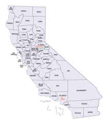
The state of California is divided into fifty-eight counties. On January 4, 1850, the California constitutional committee recommended the formation of 18 counties. They were Benicia, Butte, Fremont, Los Angeles, Mariposa, Monterey, Mount Diablo, Oro, Redding, Sacramento, San Diego, San Francisco, San Joaquin, San Jose, San Luis Obispo, Santa Barbara, Sonoma, and Sutter. The last California county to have been established is Imperial County in 1907.Tehama County, California
Tehama County Education, Geography, and History
Tehama County is a county located in the northern part of the state of California. Based on the 2010 census, the
population was
63,463. The county seat and largest city is Red Bluff.
Tehama county was created April 9. 1856. The county
is named for the City of Tehama.
Tehama County comprises the Red Bluff, CA Micropolitan Statistical Area, which is also included in the Redding-Red Bluff, CA Combined
Statistical Area. The county is bisected by the Sacramento River.
Etymology - Origin of Tehama County Name
The county is named for the City of Tehama. Tehama is an Indian word of unknown signification. Suggested possible roots are the Arabic word tehama ("hot low-lands"), the Mexican word tejamanil (shingle), or "high water" in the dialect of local Indians.
Demographics:
County QuickFacts: CensusBureau Quick Facts
Tehama County History
Tehama County was formed from parts of Butte, Colusa and Shasta Counties in 1856. The county seat is Red Bluff.
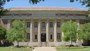
Tehama County was organized pursuant to the act of the Legislature approved April 9, 1856. Until 1860 the county rented premises for court-house and other county purposes, except jail, which was erected in 1857. The present court-house was built in 1860.
Geography: Land and Water
As reported by the Census Bureau, the county has a total area of 2,962 square miles (7,672 km2), of which, 2,951 square miles (7,643 km2) of it is land and 11 square miles (29 km2) of it (0.38%) is water.
A small part of Lassen Volcanic National Park extends into the northeast corner of the county.
Neighboring Counties
Bordering counties are as follows:
- North: Shasta County
- East: Plumas County
- Southeast: Butte County
- South: Glenn County
- Southwest: Mendocino County
- Northwest: Trinity County
Education


