


Click Image to Enlarge
California Counties
The state of California is divided into fifty-eight counties. On January 4, 1850, the California constitutional committee recommended the formation of 18 counties. They were Benicia, Butte, Fremont, Los Angeles, Mariposa, Monterey, Mount Diablo, Oro, Redding, Sacramento, San Diego, San Francisco, San Joaquin, San Jose, San Luis Obispo, Santa Barbara, Sonoma, and Sutter. The last California county to have been established is Imperial County in 1907.Tuolumne County, California
Tuolumne County Education, Geography, and History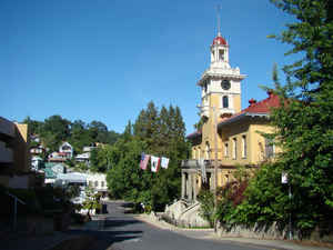
Tuolumne County, officially the County of Tuolumne, is a county in the state of California. Based on the 2010 census, the
population
was 55,365. The county seat and only incorporated city is Sonora.
The county was created February 18, 1850. The
name Tuolumne is of Indian origin and has been
given different meanings, such as Many Stone Houses, The Land of
Mountain Lions and Straight Up Steep.
Tuolumne County comprises the Sonora, CA Micropolitan Statistical Area. The county is in the Sierra Nevada region.
Etymology - Origin of Tuolumne County Name
The name Tuolumne is of Indian origin and has been given different meanings, such as Many Stone Houses, The Land of Mountain Lions and Straight Up Steep, the later an interpretation of William Fuller, a native Indian Chief. In his report to the first state Legislature, Vallejo said that the word is "a corruption of the Indian word talmalamne which signifies "cluster of stone wigwams." The name may mean "people who dwell in stone houses," i.e., in caves.
Demographics:
County QuickFacts: CensusBureau Quick Facts
Tuolumne County History
Tuolumne County was one of the original counties of California, created in 1850 at the time of statehood. Prior to statehood, it had been referred to as Oro County. Parts of the county were given to Stanislaus County in 1854 and to Alpine County in 1864.
Geography: Land and Water
As reported by the Census Bureau, the county has a total area of 2,274 square miles (5,891 km2), of which, 2,235 square miles (5,790 km2) of it is land and 39 square miles (101 km2) of it (1.71%) is water.
A California Department of Forestry document reports Tuolumne County's 1,030,812 acres (4,171.55
km2) include federal lands such as Yosemite National Park, Stanislaus National Forest, Bureau of Land
Management lands, and Indian reservations.
Neighboring Counties
Bordering counties are as follows:
- North: Alpine County
- East: Mono County
- South: Madera County; Mariposa County
- Southwest: Merced County; Stanislaus County
- Northwest: Calaveras County
Education


Click Image to Enlarge
