


Click Image to Enlarge
California Counties
The state of California is divided into fifty-eight counties. On January 4, 1850, the California constitutional committee recommended the formation of 18 counties. They were Benicia, Butte, Fremont, Los Angeles, Mariposa, Monterey, Mount Diablo, Oro, Redding, Sacramento, San Diego, San Francisco, San Joaquin, San Jose, San Luis Obispo, Santa Barbara, Sonoma, and Sutter. The last California county to have been established is Imperial County in 1907.Ventura County, California
Ventura County Education, Geography, and History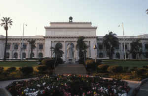
Ventura County is a county in the southern part of the state of California. Based on the 2010 census, the
population was 823,318. The
county seat is Ventura. The county
was created March 22, 1872. In 1782 the Mission San
Buenaventura was named San Buenaventura (now known
as Ventura). Buenaventura is composed of two Spanish words, buena
meaning "good"and Ventura meaning "fortune."
Ventura County comprises the Oxnard-Thousand Oaks-Ventura, CA Metropolitan Statistical Area, which is also included in the Los
Angeles-Long Beach, CA Combined Statistical Area. It is also considered as the southernmost county along the California Central Coast
Etymology - Origin of Ventura County Name
In 1782 the Mission San Buenaventura was founded as San Buenaventura (now known as Ventura). Buenaventura is composed of two Spanish words, buena meaning "good" and ventura meaning "fortune."
Demographics:
County QuickFacts: CensusBureau Quick Facts
Ventura County History
A constitution had been adopted for the California territory, by 1849, The new Legislature met and divided the pending state into 27 counties. The area that would become Ventura County was the southern part of Santa Barbara County
On January 1, 1873, Ventura County was officially split from Santa Barbara County, bringing a flurry of change. That same year, a courthouse and wharf were built in San Buenaventura. A bank was opened and the first public library was created. The school system grew, with the first high school opening in 1890
Geography: Land and Water
As reported by the Census Bureau, the county has a total area of 2,208 square miles (5,719 km2), of which, 1,845 square miles (4,779 km2) is land and 363 square miles (940 km2) (16.43%) is water.
Anacapa Island of Channel Islands National Park and San Nicolas Island are located in the county.
North of Highway 126 the county is mountainous and mostly uninhabited, and contains some of the most rugged and
unreachable wilderness remaining in southern California. Most of this land is in
the Los Padres National Forest, and includes the Chumash Wilderness in the northernmost portion,
adjacent to Kern County, The large Sespe Wilderness and portions of both the Dick Smith
Wilderness and Matilija Wilderness (both of these protected areas straddle the line with Santa Barbara
County). All of the wilderness areas are within the jurisdiction of Los Padres National Forest.
The highest peaks in the county include Mount Pinos (8831', 2697 m), Frazier Mountain (8017', 2444 m),
and Reyes Peak (7525', 2294 m), all except Reyes Peak in the San Emigdio Mountains (Pinos and Frazier
Mountain are sometimes assigned to the Tehachapis). The uplands are well-timbered with coniferous
forests, and receive plentiful snow in the winter.
Mount Pinos is sacred to the Chumash Indians. It is known to them as Iwihinmu, and was considered to be
the center of the universe; being the highest peak in the vicinity, it has a spectacular view, unimpeded
in three directions.
The Santa Clara River is the principal waterway. Lake Casitas, an artificial reservoir, is the largest
body of water.
Neighboring Counties
Bordering counties are as follows:
- Northeast: Kern County
- East: Los Angeles County
- Southwest: North Pacific Ocean
- West: Santa Barbara County
Education


Click Image to Enlarge
