


Click Image to Enlarge
Kansas Counties
Kansas has one hundred and five counties. Originally 33 counties were organized by the Territorial Legislature in 1855. The Chase County Courthouse in Cottonwood Falls, Kansas was built in 1873 and is the oldest operating courthouse in Kansas. As of January 1, 2009 Greeley County and the city of Tribune unified to form the Unified Government of Greeley County..Anderson County, Kansas
Anderson County Education, Geography, and History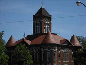
Anderson County is a county located in East Central Kansas, in the Central United States. Based on the 2010 census, the county population was 8,102. Anderson County was created on August 25, 1855. The county seat and most populous city is Garnett. The county is named in honor of Joseph C. Anderson, Kansas territorial legislator and Border Ruffian during "Bleeding Kansas".
Etymology - Origin of Anderson County Name
Anderson County is named for Joseph C. Anderson, of Missouri, who was a member of the first Kansas Territorial Legislature, and Border Ruffian during the "Bleeding Kansas".
Demographics:
County QuickFacts: CensusBureau Quick Facts
AndersonCounty History
Anderson County was named for Joseph C. Anderson, a member of the first territorial legislature, which erected and organized the county in 1855. It is located in the southeastern part of the state in the second tier of counties west of Missouri, about 50 miles south of the Kansas river and 70 miles north of the southern boundary of the state. It is 24 miles square and has an area of 576 square miles. On the north it is bounded by Franklin county, on the east of Linn, on the south by Allen and on the west by Coffey.
Geography: Land and Water
As reported by the Census Bureau, the county has a total area of 584 square miles (1,510 km2), of which 580 square miles (1,500 km2) is land and 4.1 square miles (11 km2) (0.7%) is water.
Anderson
county is located in east Kansas. Anderson county is rolling hills divided into bottom land
and timber. The creek bottoms average about 2 miles in width. Timber along the streams average three-fourths of a mile. The main water course of the county is the Pottawatomie river. The Little Osage river, Indian and Deer creeks flow through the southern portion. The trees native to this section are walnut, cottonwood, oak, hickory, hackberry, elm, sycamore, and hard and soft maples.
Neighboring Counties
Bordering counties are as follows:
- North: Franklin County
- Northeast: Miami County
- East: Linn County
- Southeast: Bourbon County
- South: Allen County
- Southwest: Woodson County
- West: Coffey County
Education


Click Image to Enlarge
