


Click Image to Enlarge
Kansas Counties
Kansas has one hundred and five counties. Originally 33 counties were organized by the Territorial Legislature in 1855. The Chase County Courthouse in Cottonwood Falls, Kansas was built in 1873 and is the oldest operating courthouse in Kansas. As of January 1, 2009 Greeley County and the city of Tribune unified to form the Unified Government of Greeley County..Butler County, Kansas
Butler County Education, Geography, and History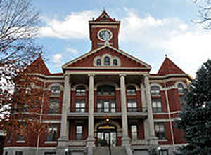
Butler County is a county located in the southern portion of the state of Kansas. Based on the 2010 census, the county
population was 65,880. Butler County was
created on August 25, 1855. The county seat and most populous city is El Dorado.
The county is named in honor of Andrew Pickens Butler
(1796-1857), United States senator from South Carolina at the time of
the Kansas-Nebraska Act organizing Kansas Territory.
Butler County is part of the Wichita, KS Metropolitan Statistical Area.
Etymology - Origin of Butler County Name
Butler County is named for Senator Andrew Pickens Butler (1796-1857) of South Carolina. Senator Butler was an ardent proslavery advocate although he had voted for the Kansas-Nebraska Act, perhaps thinking like many others that Kansas would become a slave state and Nebraska a free state.
Demographics:
County QuickFacts: CensusBureau Quick Facts
Butler County History
Butler County was one of the 33 original counties created by the "Bogus Legislature" composed of pro-slavery Missourians, border state ruffians and the fraudulently elected. A later Free State legislature allowed the name to remain unchanged. One account states that they thought Butler County was named after Massachusetts politician and later Union Army General, Ben Butler.
Butler County, Kansas' largest, is mostly rolling grass-covered hills with broad river valleys winding through them. Elevations range from 1625 feet on the east Flint Hills escarpment down to 1148 feet in the Walnut River valley.
Petroleum production and refining is still the major factor in the county's
economy. Farming and ranching are also important, and the state correctional
facility and light industry are growing segments.
Since the early days, the regional economy had been focused on farming and
ranching. This would all change when, in the fall of 1915, a cable tool drilling
rig owned by Wichita Natural Gas began to drill an oil well on the John
Stapleton farm north of town. Day after day the tools stomped their way into the
solid earth until at a depth of 670 feet oil was discovered. Word spread like a
wind-whipped prairie fire and the black gold rush was on.
Butler's economy changed almost overnight. Lease prices for land skyrocketed as
men sought riches from deep within the earth. New shops and businesses were
built to meet the demands of thousands of incoming workers.
The company owned towns of Oil Hill, Midian, Gordon, Browntown and others prospered. Oil Hill and El Dorado grew and by 1918 their population totaled almost 20,000. In a single year, more than 28 million barrels of crude oil were produced.
Geography: Land and Water
As reported by the Census Bureau, the county has a total area of 1,447 square miles (3,750 km2), of which 1,430 square miles (3,700 km2) is land and 17 square miles (44 km2) (1.2%) is water.
Butler
county is located in southeast Kansas. This county is a prairie county but has
a large amount of land of slightly rolling hills. The surface in the western part is principally "bottom" land and rolling prairie. The eastern part is in many places
fragmented and rugged. The river and creek bottoms make up about one-fifth of the area.
The main types of timber are oak, walnut, hickory, mulberry, sycamore, elm and hackberry. The
primary streams are the Whitewater, in the northwest part of the county, which joins the
Walnut at Augusta. These two streams have a number of tributaries, the most important of the Whitewater
are Henry, Wentworth, Bakers, Rock and Meadow creeks; those of the Walnut the Cole, Durechon, Satchels, Bemis, Bird, Turkey, Four Mile, Little Walnut, Eight Mile and Muddy creeks.
Limestone is plentiful and widespread quarries have been developed, from which large quantities of stone are shipped to nearby cities. Gypsum has been found in small quantities in the western part of the county. Coal is found in thin layers in some places but has never been mined extensively.
The soil is rich and deep, adjusted to the growth of almost every variety of grain and fruit.
This county is the largest county by area in Kansas.
Neighboring Counties
Bordering counties are as follows:
- Northeast: Chase County
- East: Greenwood County
- Southeast: Elk County
- South: Cowley County
- Southwest: Sumner County
- West: Sedgwick County
- Northwest: Harvey County; Marion County
Education
Unified School Districts
USD 205, Bluestem - Leon, Latham, Rural Areas
USD 206, Remington-Whitewater - Whitewater, Potwin, Elbing, Rural Areas - Frederic Remington High School
USD 375, Circle - Towanda, Benton, Rural Areas
USD 385, Andover - Andover, Rural Areas
USD 394, Rose Hill - Rose Hill, Rural Areas
USD 396, Douglass - Douglass, Rural Areas
USD 402, Augusta - Augusta, Rural Areas
USD 490, El Dorado - El Dorado, Rural Areas
USD 492, Flinthills - Rosalia, Cassoday, Rural Areas
District Office In Neighboring County
USD 398, Peabody-Burns -Rural Areas
Private schools
Berean Academy, in Elbing
College
Butler County Community College, in El Dorado


Click Image to Enlarge
